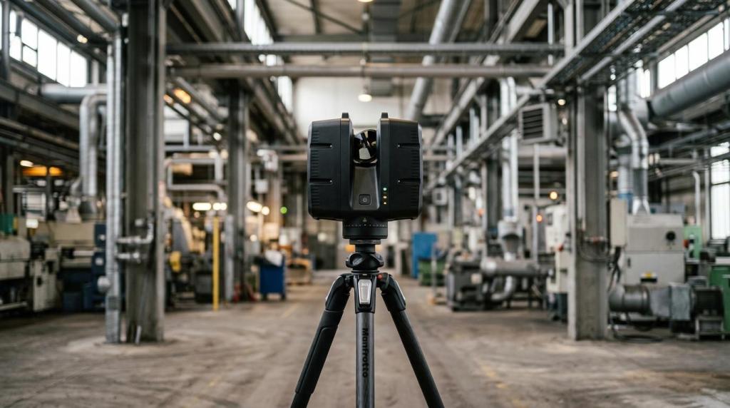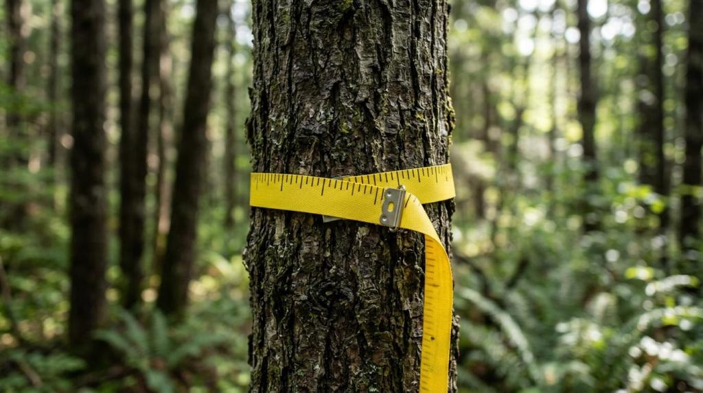
When forestry LiDAR data needs to be processed quickly, a good scanner alone is not enough. The real difference comes when a point cloud turns, within a short time, into usable outputs for forest inventory, stand management, harvest planning or input for further analyses.
This is exactly where the Forest module in FJD Trion Model comes in. It is a specialised environment for working with point clouds that converts captured data into specific tree attributes and reports. Instead of measuring every trunk by hand in the field, a large part of the work can be moved to digital processing, significantly shortening the time from data capture to decision.
FJD Trion Model and the Forest module for processing forest data
FJD Trion Model is software for processing and analysing 3D point clouds from LiDAR scanners. According to the product materials of 4CAD, it offers more than 30 processing tools, six industry editions and runs on both PC and iPad. This matters above all to teams that want to combine field checks and office processing in a single environment.
The Forest module extends basic point cloud work with forestry functions. Official FJD materials state that the module can extract tree attributes such as tree position, height and crown width, as well as batch reports. The 4CAD page also mentions further parameters, including DBH, crown diameter, wood volume and automatic tree detection.
This means the software is not just for viewing data, but for turning it into measurable, exportable information.
Technically, it is important that the whole process follows the standard LiDAR scanning workflow. Data can be captured in the field, converted into a point cloud, cleaned, evaluated and then transferred into reports or into other CAD, GIS and planning systems. In practice, this is often precisely the step that decides whether scanning is truly efficient.
After a first look at the software, these are the features most worth watching:
- Industry focus: forestry functions are not just an add-on but a dedicated working mode
- Automated outputs: less manual transcription and fewer repeat measurements
- Point cloud processing: measurement, analysis, filtering and interpretation in one environment
- PC and iPad
- batch export of reports
- connection to further digital processing
Forestry attributes from the point cloud in the Forest module
The biggest benefit of the Forest module is that the point cloud does not just become a visually impressive 3D record of the stand, but a set of attributes you can keep working with. That is the key difference between mere data capture and truly usable forest digitisation.
Users usually need quick answers to a few practical questions: where the trees stand, how tall they are, what their crowns are like, what the trunk diameter at breast height is and what the summary characteristics of the plot are. If the software prepares this data automatically or semi-automatically, it saves time not only in the office but also during repeated field checks.
The following table shows which attributes tend to be most valuable for forestry work:
| Attribute | What it means | Typical use |
|---|---|---|
| Tree position | Coordinates or exact position in the stand | tree map, orientation on the plot, planning of interventions |
| Tree height | Vertical dimension from base to top | inventory, growth assessment, growing stock estimates |
| DBH | Trunk diameter at breast height | basic forestry indicator for records and volume calculations |
| Crown width | Crown spread in plan view | assessment of vitality, density and competition between trees |
| Crown diameter | More detailed crown parameter | modelling of stand structure |
| Wood volume | Estimate of timber volume | management planning and balances |
| Batch reports | Summary tables and exports | handing data over to the investor, forest manager or analyst |
DBH deserves a brief explanation. It is the trunk diameter at breast height – a standard forestry measure without which accurate stand records are hard to keep. If the software can extract this parameter directly from the point cloud, a large part of the manual work disappears.
Some 4CAD materials also mention species identification. This is an interesting feature, especially where several data layers are combined and the user needs not just geometry but a broader description of the stand.
Saving time in forest inventory with LiDAR
The main reason to consider the Forest module is not just accuracy. It is the speed and scale of processing. Traditional field measurement is proven, but on larger areas it tends to be slow, physically demanding and hard to scale. LiDAR provides dense spatial coverage, so the stand can be evaluated as a whole rather than only through a few sample points.
Expert sources confirm this. The U.S. Forest Service states that LiDAR-derived variables can reduce the amount of labour-intensive fieldwork while providing continuous spatial coverage of the area of interest. According to the agency, some studies show accuracy comparable to traditional inventory methods. In practice, what matters most is that field data then serves mainly for calibration and validation rather than for collecting everything by hand.
The time savings do not come from a single step. They add up from several smaller accelerations that together make a significant difference.
- less manual measurement in the field
- less transcription of data into spreadsheets
- faster checks of larger areas
- repeated evaluation without returning to the site
- easier data sharing between teams
In practical terms, the same dataset can be used again and again. Once a high-quality point cloud exists, you can return to it to add outputs, check a specific part of the stand or create further reports. This is very valuable when output requirements change during a project.
Significant savings also arise in communication between disciplines. A forester, surveyor, GIS specialist, designer or land manager does not need to collect data separately each time. One high-quality scan can serve several purposes at once.
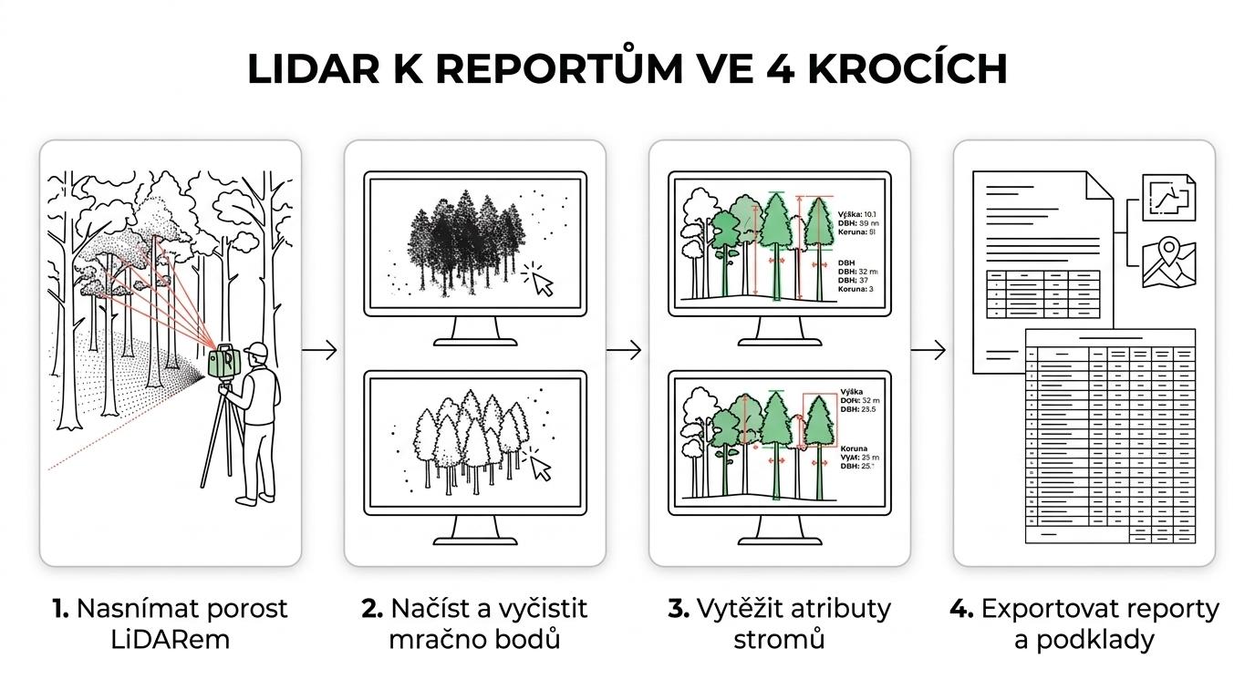
A typical workflow in FJD Trion Model
To make the benefits of the Forest module clear, it helps to look at a typical workflow step by step. It is not a complicated chain, but it matters that the individual phases follow on from each other without unnecessary gaps.
A typical process might look like this:
- Data capture in the field: a LiDAR scanner captures the stand and creates the basis for a 3D point cloud.
- Import and preparation of the point cloud: the data is loaded into FJD Trion Model, where basic checks, cleaning and any necessary filtering take place.
- Forestry analysis in the Forest module: the software identifies the trees and extracts the required attributes.
- Export of outputs: reports, tables and input data for other CAD, GIS or planning tools.
The main value of this process is that it does not require jumping between a large number of isolated programs. If a team uses FJD Trion scanners and the related software within the same ecosystem, the whole process tends to be faster and clearer.
From a company rollout perspective, it is also worth noting that the software is not limited to forestry. Anyone already using FJD Trion Model in other disciplines can have a common basis for several industry tasks. This reduces the demands on training and data management.
Data processing on PC and iPad
Support for PC and iPad may sound like a detail, but in daily operation it is very useful. The field team can quickly check the data outside the office, while the more detailed analysis takes place on a powerful workstation. This way of working tends to be more practical than waiting until you are back in the office, only to find that some of the data needs to be supplemented.
The 4CAD page also mentions a 30-day trial, which is a sensible way to verify whether the workflow matches your specific needs. For forestry projects, this is particularly useful when the team wants to test a real dataset rather than just a demo scenario.
When the Forest module pays off most
Not every project needs detailed forestry analytics. But if an organisation regularly works with forest stands, inventory, land management or the planning of silvicultural interventions, this type of software makes clear sense.
The Forest module delivers strong benefits above all where a larger number of trees must be processed consistently and without lengthy manual measurement. The larger the area, the more frequent the repetition and the higher the reporting requirements, the better the return on the time invested.
Good use cases include:
- Stand inventory: a quick overview of the basic tree parameters
- Forest asset management: consistent data that can be obtained repeatedly
- Intervention planning: decision support based on spatial data
- Research and monitoring: the option to return to the same dataset
- Input for other specialists: sharing data with GIS experts, designers or analysts
Major benefits can also be expected in combination with broader digitalisation. If an organisation already works with CAD, BIM, GIS or other 3D data, the point cloud is a natural common language. Related expert articles on Techcad.cz and product information on FJD Trion Model at 4CAD may also be of interest.
What to look for when choosing software for forestry reports
Choosing software is not just about a list of features. What also matters is how quickly the team gets from a scan to a usable output and how many manual interventions it has to make along the way. In practice, it pays to look not only at tree detection but also at export quality, workflow stability and integration with other tools.
It is also important to verify how accurately the software handles your typical scenarios. Dense stands, rugged terrain, different tree species or varying input data quality can have a major impact on the result. That is why it makes sense to test with your own data.
When evaluating a solution, it helps to ask a few simple questions:
- Can the software reliably extract tree position, height, DBH and crown parameters?
- How quickly is a report produced after the data is loaded?
- Can the data be conveniently checked outside the office as well?
- Does the output connect to other systems the company already uses?
- Is a trial or validation on a real dataset available?
When these criteria come together in one tool, LiDAR in forestry makes much more sense – not as a flashy technology for presentations, but as a working tool that speeds up information gathering, makes stand data clearer and helps you make decisions based on more accurate data. The Forest module in FJD Trion Model fits squarely into this direction. Its strength lies not only in the 3D visualisation of the forest, but in turning the point cloud into usable forestry information without wasting time.