
Cart (
0
)
No items found.
Go to pricingProduct is not available in this quantity.
Unmanned surface vessels (USVs) for bathymetry, hydrography and riverbed and seabed mapping. One platform, five models – from the compact APACHE 3 and the versatile APACHE 4 with ADCP to the flagship APACHE 6 trimaran with a multibeam echosounder and LiDAR. Autonomous navigation, centimetre-level GNSS+INS positioning and control from an Android controller, no laptop required.
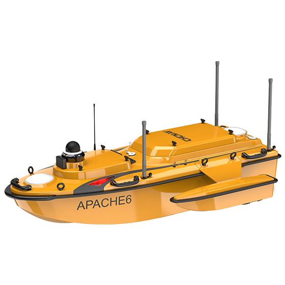
APACHE is a series of autonomous unmanned surface vessels (USVs) from CHC Navigation. It is a survey platform: a carbon-fibre hull, GNSS RTK with an inertial measurement unit, electric propulsion and an interchangeable sensor well. Depending on the sensor fitted, it becomes a tool for bathymetric surveys, hydrographic surveys or inspections – even where a conventional boat can't go.
The integrated 200 kHz single-beam echosounder measures depths in the 0.1–200 m range with an accuracy of ±0.01 m + 0.1% × D. The output is a digital bottom model, depth contours (isobaths) and longitudinal and cross-sections.
An optional multibeam echosounder captures a full swath of the bottom in one pass instead of a single track. The result is a dense point cloud for sediment modelling, volume calculations and inspection of underwater structures.
The APACHE 4 and 4 Pro can carry an ADCP for measuring discharge, velocity fields and cross-sections – for water management authorities, river basin agencies and flood studies.
Draw the route on a map and the vessel runs it on its own, holding the survey line even in current. GNSS RTK combined with an inertial unit maintains position and heading even under a bridge or next to a high bank.
A draft of 7.5–10 cm and a weight from 6 kg mean that two people can deploy it – no ramp or crane needed. The vessel reaches harbour berths, the areas under bridges, reservoirs and shallow rivers.
The sensor well can also take a LiDAR for simultaneous above- and below-water data capture, a sound velocity profiler (SVP), a side-scan sonar or water quality probes.
From arrival on site to a finished bottom model. Two people can handle the entire cycle, and all operation typically runs from a single Android controller.
Define the area of interest and the line spacing on the map. The software generates the survey plan, including run-ins and turns at the end of each line.
The vessel runs the survey lines on its own. On the controller you monitor depth, position, coverage and battery status in real time, and you can switch to manual control at any time.
An SVP probe measures the speed of sound in the water column, and check cross-lines verify accuracy. A 360° camera and obstacle detection keep an eye on operations.
The measured data are turned into a digital bottom model, depth contours, profiles and sediment volumes – in formats that load into CAD and GIS.
The APACHE 6 is an autonomous USV for high-resolution 3D bathymetric surveys, underwater object localization and offshore construction. Its trimaran hull with detachable floats and dual rotating propellers ensure stability even in fast-flowing water and a turning radius of just 2 metres. It carries a payload of up to 60 kg – enough for a NORBIT multibeam echosounder together with a LiDAR. That is the main difference from the smaller APACHE 3 and 4 models.
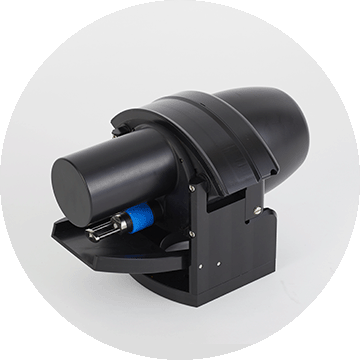
The optional multibeam echosounder captures a full swath of the bottom at once. Instead of a single depth track, you get a dense 3D point cloud for bottom models, volumes and structural inspections.
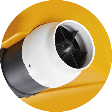
Twin rotating propellers direct the water flow. The vessel turns within a 2-metre radius and holds its planned line even in current or on a narrow waterway.
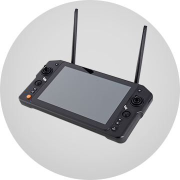
See vessel status and survey data in real time directly on the controller. No laptop on the bank, no cables – one person can run the survey.
Five design features that determine the data you ultimately get from a survey.
Carry out precise 3D bathymetric surveys with optional multibeam echosounders and a LiDAR scanner. Collect high-resolution data and improve the accuracy of underwater object localization and offshore construction.
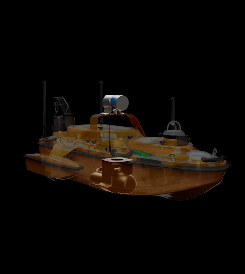
The trimaran design of the APACHE 6 and its detachable side floats provide a stable position and greater adaptability, ensuring optimal stability even in fast-flowing water.
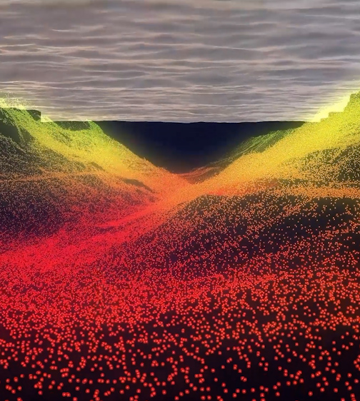
The APACHE 6 supports an optional kit for automatic sound velocity profiling (SVP), operated directly from the remote controller. The kit can be installed or removed in less than a minute – a complete multibeam echosounder solution for a USV.
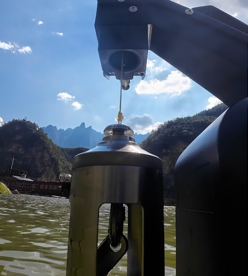
The APACHE 6 uses intelligent rotating propeller technology to adjust the direction of water flow. This allows a turning radius of just 2 metres – ideal for narrow waterways – and increases the efficiency of multibeam bathymetric surveys.
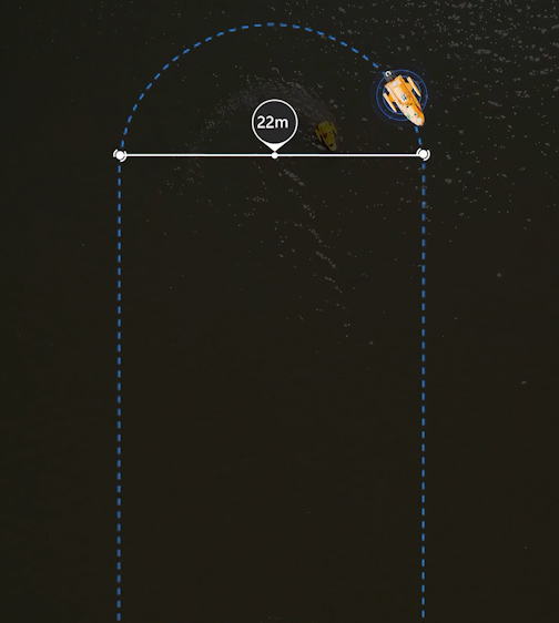
The Android controller gives real-time access to vessel status and survey data without a computer. An intuitive interface keeps surveys efficient, and multi-level communication enables long-range data transmission for seamless control of the APACHE 6.
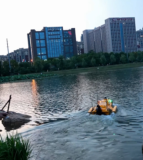
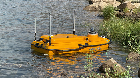
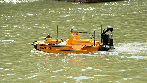
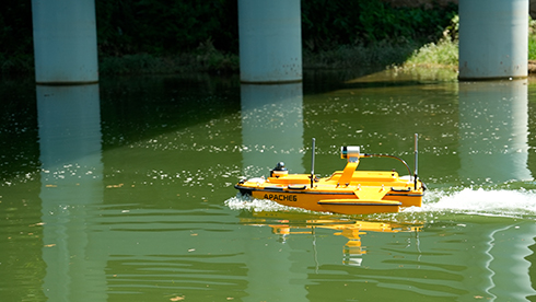
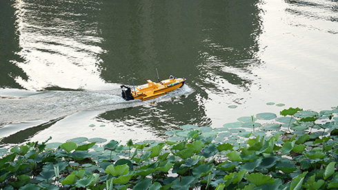
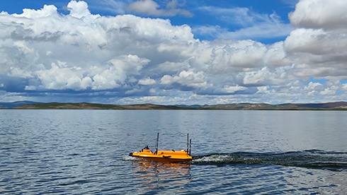
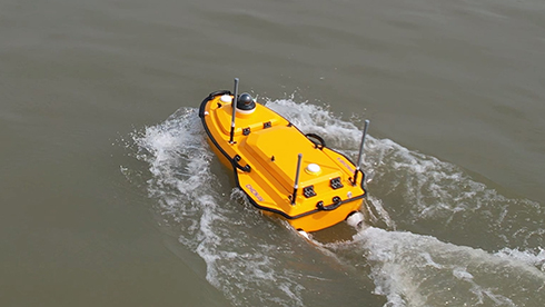
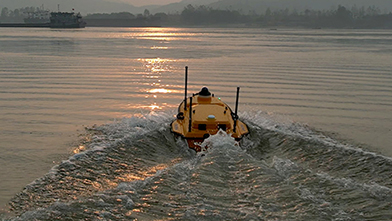
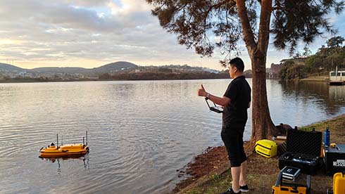
The vessel is the carrier. What it measures depends on the sensor in the central well – and that can be swapped to suit the job. Below is an overview of the configurations we most often supply with the APACHE platform.
The standard equipment for depth measurement. The integrated 200 kHz echosounder covers a range of 0.1–200 m with an accuracy of ±0.01 m + 0.1% × D. Depending on the configuration, it uses CHCNAV D270, D390 or D60 series sounders. Suitable for rivers, reservoirs, ponds and routine bottom surveys.
For 3D bottom mapping in a single pass. The APACHE 4 and 4 Pro carry the CHCNAV HQ-400 multibeam, while the APACHE 6 is optimized for NORBIT iWBMS and WINGHEAD systems. The output is a dense point cloud instead of a single depth track.
Measurement of discharge, velocity fields and cross-sections with CHCNAV RS600, RS1200 or River Star 3600D sensors. Typically used by river authorities, river basin agencies and in hydrological studies – with the APACHE 4 or 4 Pro as the platform.
The optional NORBIT iLiDAR on the APACHE 6 captures what lies above the water simultaneously with the echosounder – banks, quay walls, bridge structures and overhead lines. A single pass gives you a seamless 3D model above and below the waterline.
Without a known sound velocity, multibeam surveys are not accurate. The optional SVP kit is operated directly from the remote controller and can be mounted or removed in less than a minute – you measure the profile during the survey, not back at the office.
Common to the entire range: GNSS RTK with an inertial unit (0.8 cm horizontal, 1.5 cm vertical), 360° camera, obstacle detection, 2.4 GHz radio link up to 1 km and backup transmission via 4G LTE. Controlled from an Android controller, no laptop needed.
Need a different configuration? The sensor well can also be fitted with other instruments – such as a side-scan sonar or water quality probes. Tell us what you need to measure.
* Integrated single-beam echosounder; the multibeam echosounder and LiDAR scanner are optional. Data based on the CHCNAV manufacturer's datasheet.
Five models on the same platform. They differ in size, payload and the sensors they can carry – everything else (positioning, control, communication) is shared.
Swipe the table sideways →
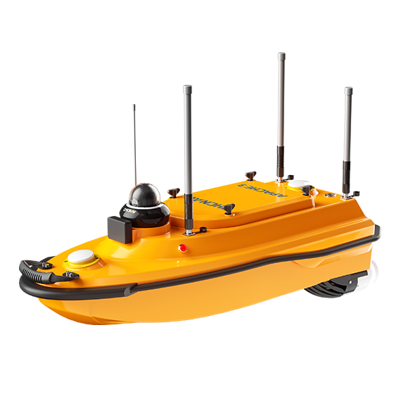 APACHE 3
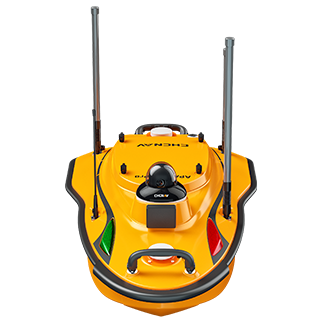 APACHE 3 Pro
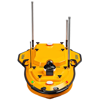 APACHE 4
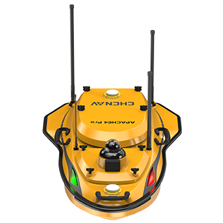 APACHE 4 Pro
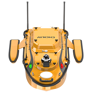 APACHE 6
Items marked “optional” depend on the chosen configuration. Values are based on CHC Navigation datasheets; we always confirm the exact configuration in our quote.
Two short manufacturer videos show what survey accuracy relies on and how long the vessel lasts in the field.
Dual GNSS antennas determine position and heading, while the inertial unit adds roll and pitch. Data stay consistent even where the signal degrades – under bridges or next to high banks.
The brushless drive holds the planned line even against the current. Power management extends operation on a single charge to up to ten hours, so most sites can be completed in one day.
Videos and product photos: CHC Navigation.
It comes down to the scope of the project and the sensor you need to carry. A detailed comparison of all five models is in the table above – here is a quick guide.
A cost-effective single-beam USV for routine bathymetric surveys. Choose it when a single depth track is enough – ponds, smaller reservoirs, channel surveys and siltation checks.
Enquire ›A versatile USV for hydrographic and bathymetric surveys. Choose it when you measure discharge with ADCP or want multibeam on a lightweight boat that one person can transport.
Enquire ›The flagship trimaran USV for high-resolution 3D multibeam bathymetry, LiDAR and offshore construction. Choose it for demanding projects and heavy sensors.
Product details ›Tell us what you need to survey and where. The 4CAD team will select the right APACHE model and propose a sensor configuration – from a single-beam echosounder and ADCP to multibeam with an SVP probe.
Contact us todayNo-obligation enquiry – we'll prepare a configuration and price tailored to you.
Multibeam echosounders deliver detailed bathymetric data over large areas and enable accurate mapping of underwater features for marine navigation and construction.
The APACHE 6 is designed for high-resolution 3D bathymetry, underwater object localization and offshore construction. It is made of high-strength carbon fibre that withstands harsh environments.
Its lightweight design allows easy deployment by two operators, making the vessel versatile and efficient in a wide range of conditions.
The trimaran design with detachable floats maintains stability even in fast-flowing water and ensures consistent data quality.
Pricing depends on the configuration you choose. For a detailed quote, please contact us using the enquiry form below.
The integrated single-beam echosounder measures in the 0.1–200 m range with an accuracy of ±0.01 m + 0.1% of depth. Position is determined with an accuracy of 0.8 cm horizontally and 1.5 cm vertically (GNSS RTK with an inertial unit). The actual accuracy of the final bottom model also depends on a known sound velocity in the water – which is why we recommend an SVP probe for multibeam surveys.
A bottom point cloud (XYZ or LAS), digital bottom model, depth contours and depth map, longitudinal and cross-sections of the channel, and sediment volumes for dredging. With ADCP surveys, also discharge and velocity fields. The data can be further processed in standard CAD and GIS tools.
A single-beam echosounder (SBES) measures depth along a single track directly beneath the vessel – sufficient for profiles and routine bottom surveys. A multibeam echosounder (MBES) captures a full swath of the bottom several times wider than the depth beneath the boat – so a single pass covers a much larger area and gives you a seamless 3D model. The trade-off is a higher price and more demanding calibration.
It depends on the area and line spacing. Depending on the model, the battery lasts 6 to 10 hours of operation, so a typical reservoir or river section can be surveyed in a single day, including preparation and check cross-lines. Swappable batteries let you keep going without waiting for a recharge.
The vessel itself is survey equipment, but navigation rules vary depending on the waterway and its authority. Before deploying on a designated waterway, check the conditions with the waterway authority or, in the Czech Republic, with the State Navigation Administration. We'll be happy to help you prepare the survey.
We will be happy to advise you and call you back.
Leave us your contact details and our sales representative will get in touch as soon as possible to explain everything in detail.