
FJD Trion X1 – handheld LiDAR scanner with built-in display
A handheld 3D LiDAR scanner with a guided workflow: plan the task in advance, the operator completes it on site step by step, and everything ends up in a single report. GNSS, LiDAR, 360° cameras and a 3.9" OLED display in one device.
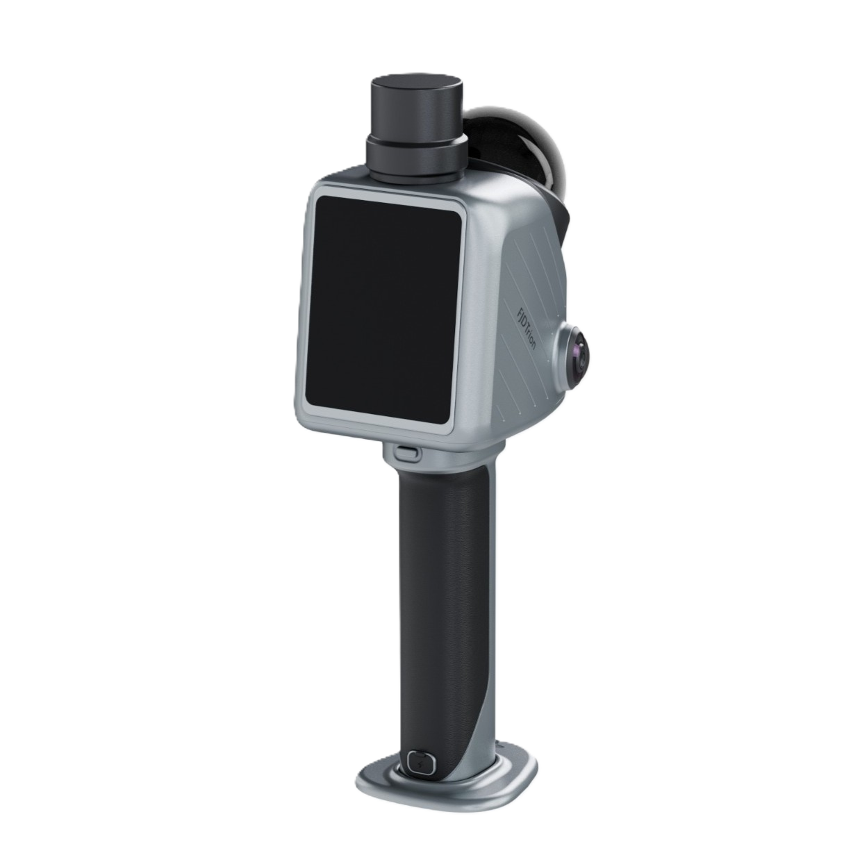
Professional scanning without unnecessary steps
≤ 1 cm
Relative point cloud accuracy

360° × 360°
Field of view of the panoramic cameras

384,000
Points per second

5 hours
Runtime on one set of two batteries

35 metres
Range in every direction

Ready to go, no assembly
X1 combines GNSS, LiDAR, 360° imaging and a built-in display in one device and supports an external microphone. The base arrives factory-assembled, so setup on site takes minimal time.

Distraction-free operation
Leave messages, notifications and calls aside – scanning belongs on the scanner. On the built-in display the operator sees where they are pointing and what is being captured, with no second device to keep an eye on.

A complete record of the entire site
Dense LiDAR and built-in 360° imaging capture both geometry and visual context in a single pass. Sharper corners, cleaner edges, straighter lines and richer site detail – a better basis for deliverables.

Leave the site with confidence
The hard part isn't starting a scan, it's knowing when to stop. The X1 display is a live window into the field: check the captured data on the spot, reduce uncertainty and repeat scans, and move smoothly from data capture to final deliverables.

A guided workflow from plan to report
Sending someone to site is easy. Being sure they capture exactly what you need is harder. With X1 you define a specific task in advance, the operator receives it directly on the device and, following on-screen instructions, scans the site, records defects and combines everything into one final report.
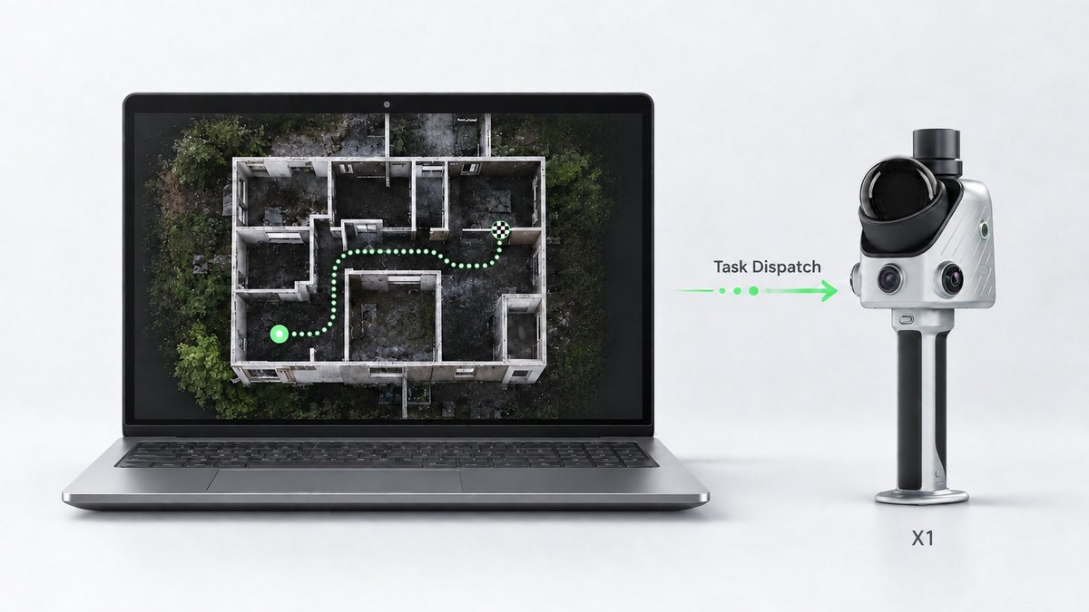
1. Plan
In FJD Trion Model Web, define the area, route and scanning priorities in advance and send the task straight to X1.
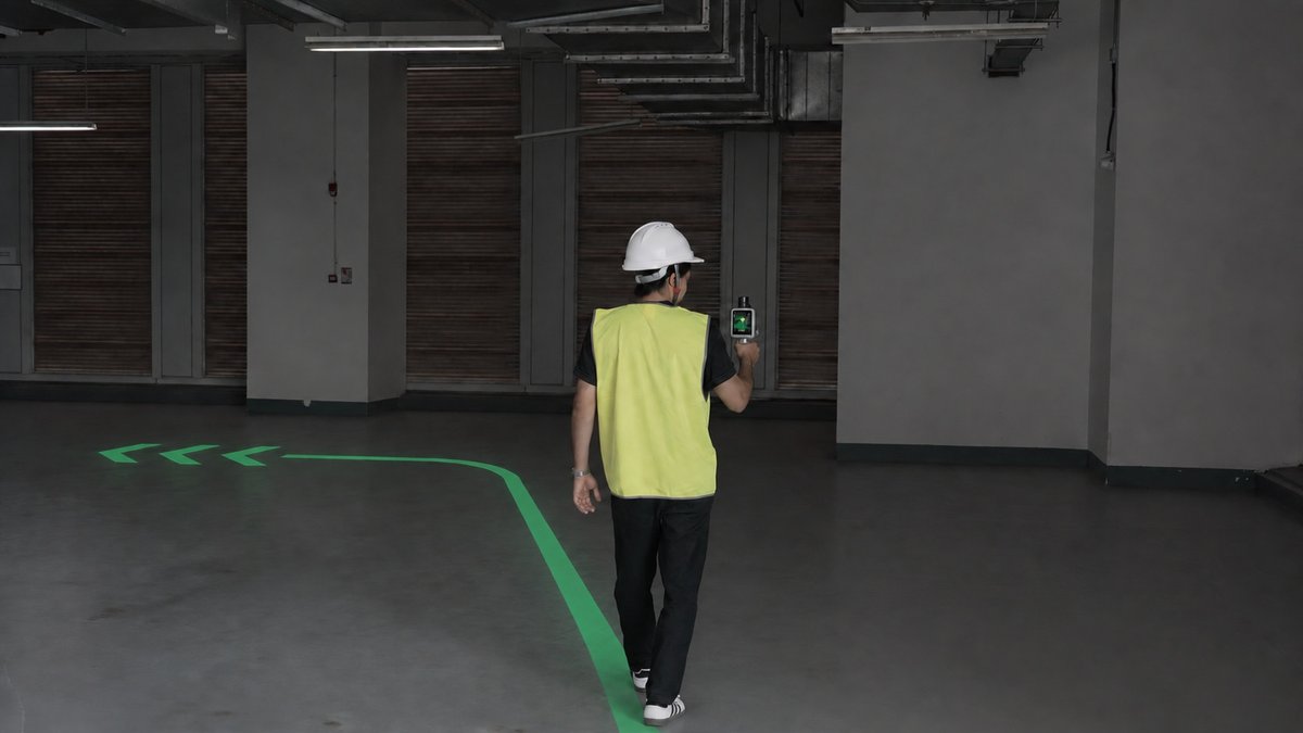
2. Data capture
The operator follows route navigation on the display and needs no separate instructions or phone.
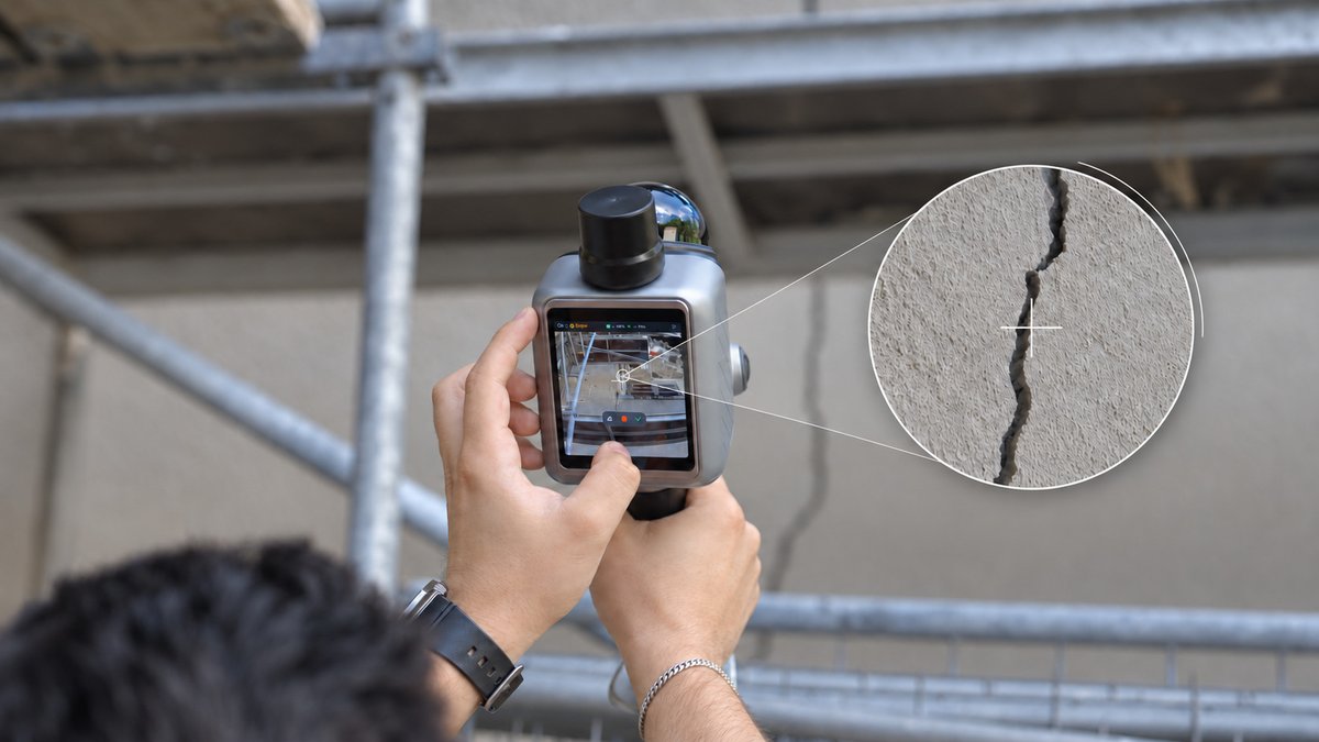
3. Documentation
Using the crosshair, they mark a defect directly in the 3D record and add a voice note, which Model Web transcribes in supported languages.
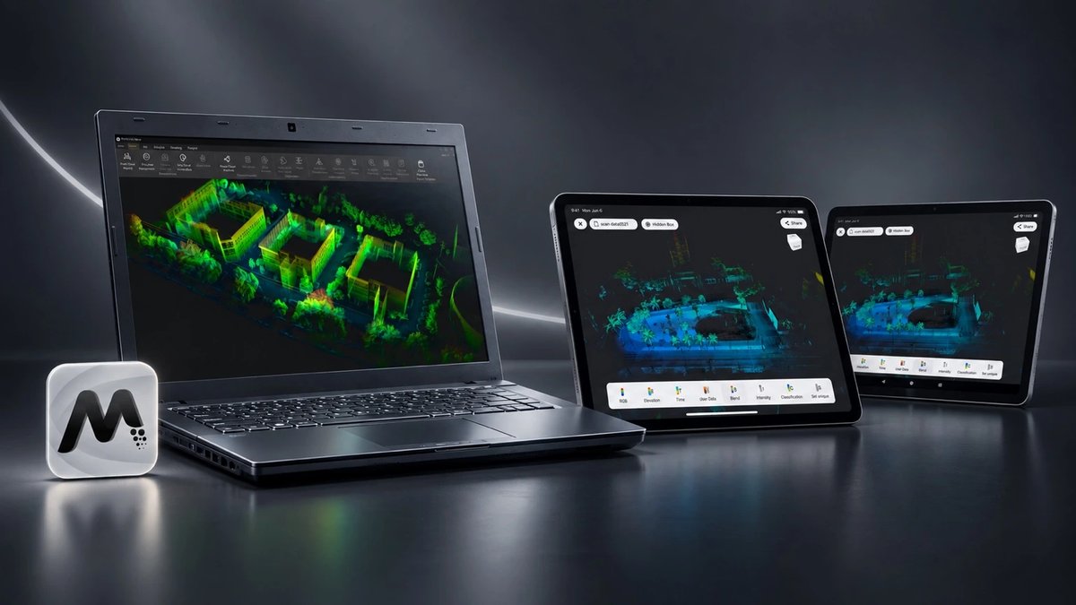
4. Review and report
Combine scans, defects, route and notes in Model Web and generate a report for review and sharing. Detailed point cloud editing is handled by FJD Trion Model on PC and tablet.
Where X1 is used

Construction and as-built
Recording construction progress, conditions during renovations, building services installations and as-built 3D documentation.
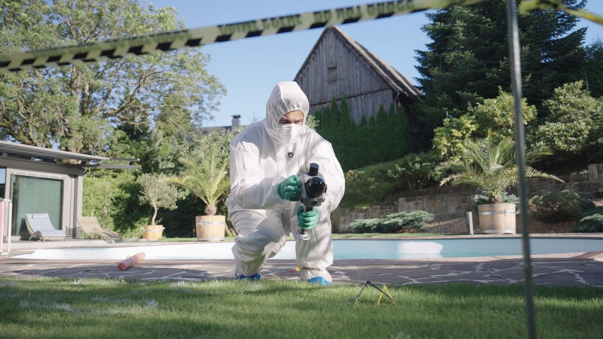
Accidents and safety
3D and panoramic records of accident scenes for safety documentation and investigations.
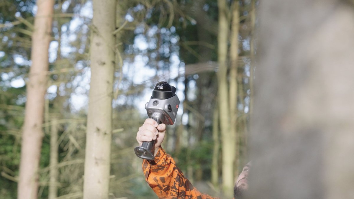
Green spaces and sites
3D records of urban greenery, site roads, green strips and landscape features.

Stockpiles and material storage
3D records of stockpile and material storage volumes with GNSS positioning.
Technical specifications
* Lab-verified accuracy. Actual results vary depending on the environment, workflow and operating conditions.
FJD Trion X1 FAQ
What is the FJD Trion X1?
A handheld 3D LiDAR system for reality capture, designed for teams that need consistent 3D records across multiple sites, operators and projects. It combines LiDAR, 360° imaging, GNSS support, a built-in display and a guided workflow.
How does X1 differ from a standard LiDAR scanner?
Standard scanners rely heavily on operator experience. X1 brings a guided field workflow: you define capture requirements in advance, on-screen instructions guide the operator, notes are saved directly with the record and everything comes together in one place for review.
What is X1 used for?
Checking construction work, as-built documentation, recording renovations and building services, safety inspections, forensic documentation, municipal asset records and documenting material stockpiles.
What range and accuracy does X1 have?
The range is 35 m in every direction (70 m across) and the capture rate is 384,000 points per second. Relative point cloud accuracy after processing is within 1 cm, absolute accuracy 3 cm (lab-verified; actual results depend on the environment and workflow).
Does X1 support GNSS?
Yes. X1 supports GNSS for outdoor work where you need georeferenced data – for example mapping sites, recording outdoor assets or documenting stockpiles.
Can I record voice notes while scanning?
Yes. The operator can record voice notes during capture and even connect an external microphone. Model Web transcribes the notes in supported languages, so they are easy to share with the team.
How much does X1 weigh and what is its IP rating?
The main unit weighs 900 g, the complete set 1.3 kg. The device is rated IP54 and operates from −20 °C to +50 °C.
Want to see X1 in action?
We will show you the scanner on your own project, walk you through the whole process from capture to deliverables and prepare a tailored quote.