
3D laser scanners for construction
Professional LiDAR scanners for land surveying, construction, GIS and industrial applications. Compare the models and choose the right 3D laser scanner for your project.
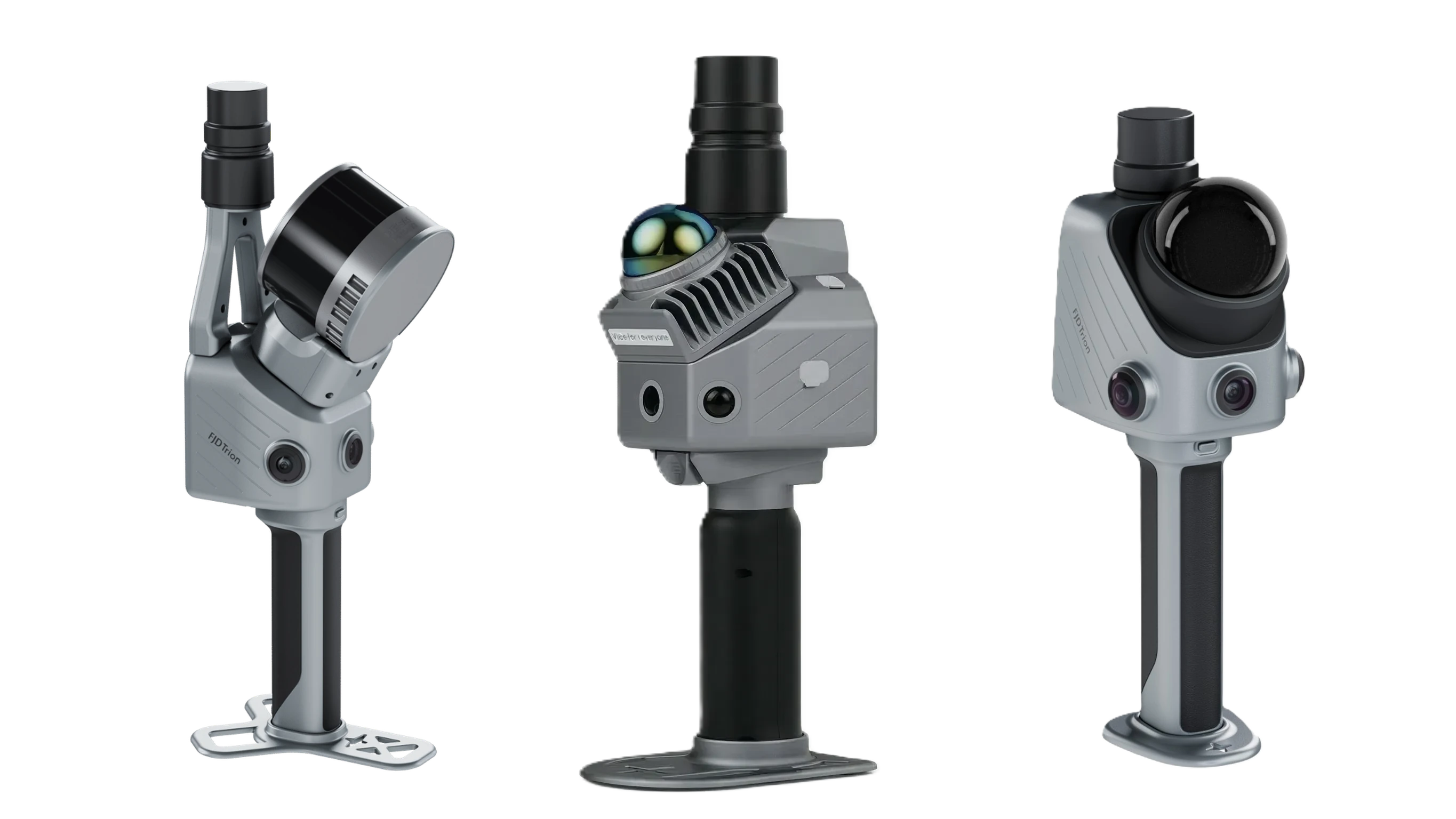
OVERVIEW AND CAPABILITIES
Using 3D technology across the building life cycle
FJD Trion T1
A hybrid scanner for the whole job: mobile mode with a range of up to 120 m and tripod scanning with 4 mm accuracy at 10 m – 640,000 points/s, GNSS with RTK.
More about T1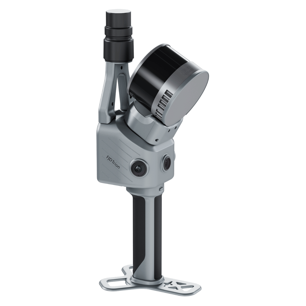
FJD Trion S2 Series
Powerful 3D LiDAR scanner (weight 1.8 kg) with a range of up to 300 metres (Max version), a speed of 640,000 points/s and 10 mm accuracy
More about S2
FJD Trion X1
Compact scanner with a built-in display, GNSS and 360° cameras – 384,000 points/s, a range of 35 m in every direction and relative accuracy of ≤ 1 cm
More about X1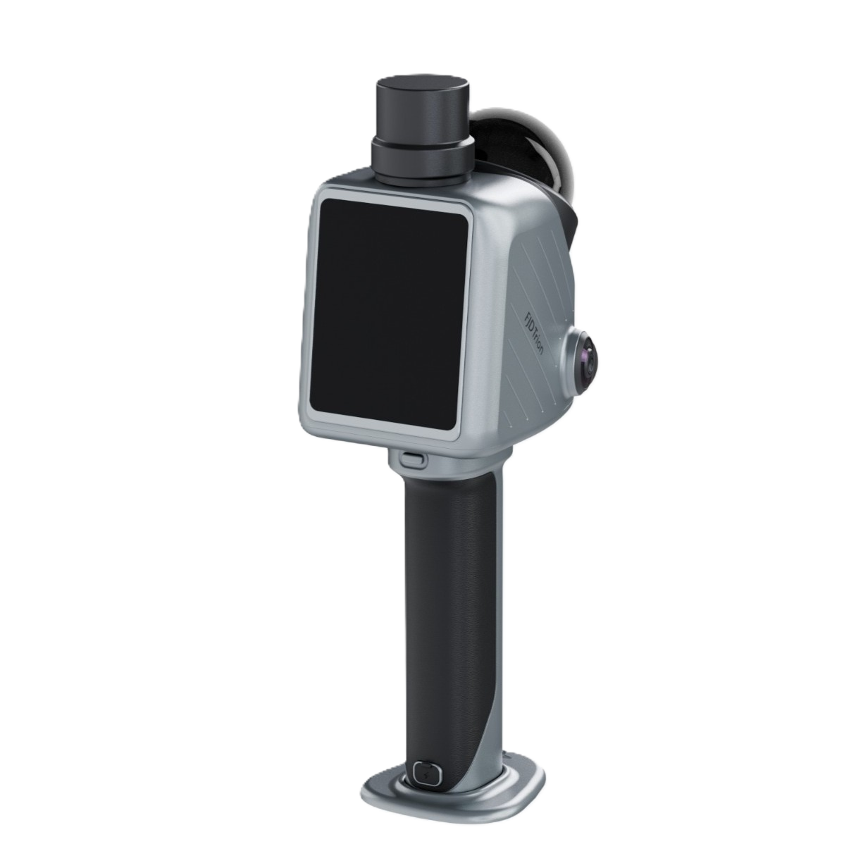
FJD Trion P2
The FJD Trion P2 3D LiDAR scanner delivers professional performance in an ultra-light body (700 g), with 10 mm accuracy and a range of 35 m in every direction.
More about P2
FJD Trion P2
Vision +
The FJD Trion P2 Vision+ 3D LiDAR scanner offers a unique combination of a construction 3D scanner and a professional thermal camera for detecting defects and thermal bridges
More about P2 Vision+
Geomate
GS60
The Geomate GS60 3D LiDAR scanner is a unique handheld 3D scanner with high point density for accurate, detailed digitisation of buildings and creation of BIM models.
More about Geomate GS60
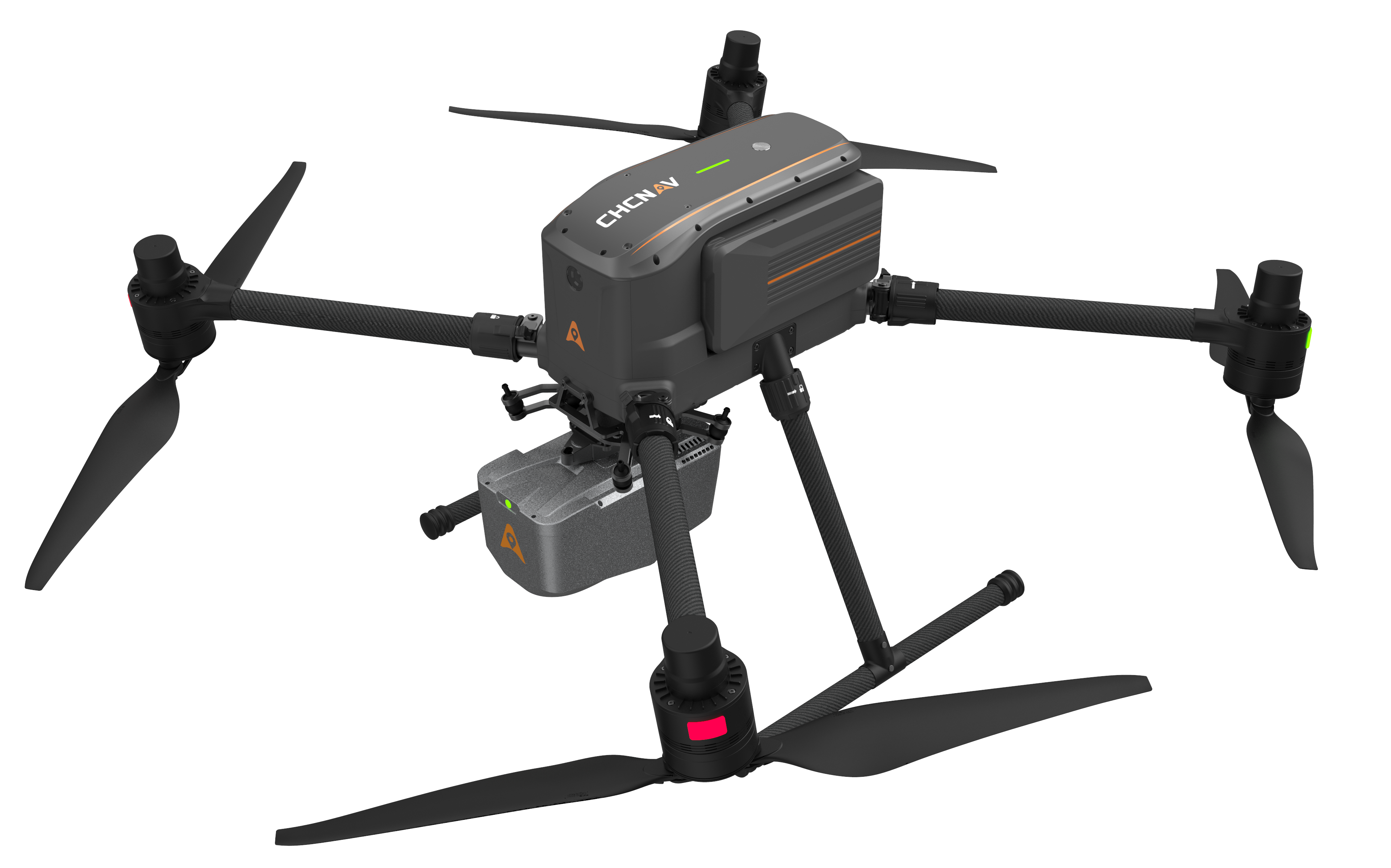
X500 drone + LiDAR
Combining the CHCNAV X500 industrial drone with AlphaAir 6 / 6 Dual airborne LiDAR sensors gives you an uncompromising tool for professional 3D scanning and photogrammetry. With a payload of up to 5 kg, a rugged IP55 design and an extended flight time of up to 50 minutes per mission, you can cover huge areas with dense vegetation, even in the toughest conditions. Get millimetre-accurate point clouds, orthophoto maps and digital terrain models in record time.
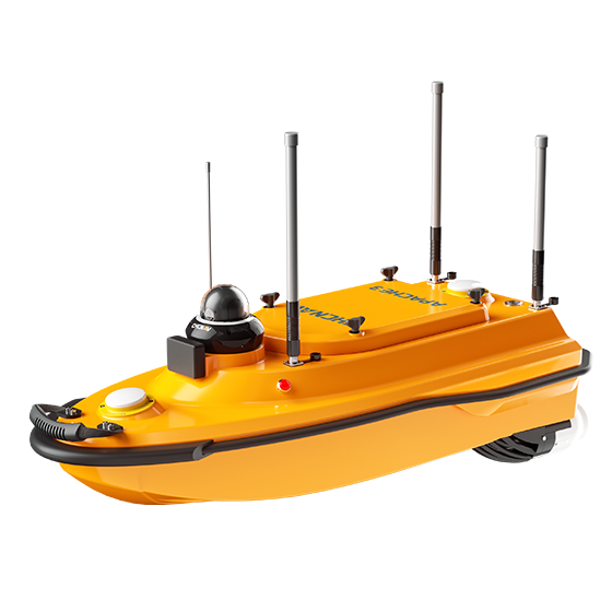
CHCNAV APACHE platform
Combining the CHCNAV APACHE unmanned surface vessel with precise sonar systems gives you an uncompromising tool for professional hydrographic surveying and bathymetry. Thanks to autonomous navigation, high stability even in strong currents and a rugged hull, you get detailed data from shallow waters and hard-to-reach locations. Get millimetre-accurate digital bed models, detailed profiles of water bodies and volume analyses in record time.
Geomate GS60 / Trion P2
Choose the Geomate GS60 or Trion P2 scanner and rent it for your project. No deposit and a simple rental process – for as long as you need.
Construction scanner rental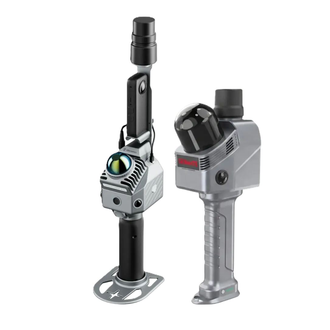
Speed and efficiency
Cuts survey time by up to 90%
compared with traditional methods.
Scan while walking (SLAM) or from a tripod, with
an instant data preview.
Millimetre accuracy
Eliminates human error. Every scanned point (point cloud) has precise XYZ coordinates, giving you a flawless basis for
design.
A basis for BIM
The data is fully compatible with CAD/BIM software, enabling digital twins, sections, elevations and volume calculations at true
scale.
Technology selection guide
Choosing the right 4-CAD LiDAR depends primarily on the type of project:
- Building documentation and interiors: Mobile SLAM scanners
(X1, P2) for moving smoothly through complex spaces. - Facades and exteriors: Devices with greater range and point
density (S2 series) for capturing detail from a distance. - Engineering surveys: RTK/GNSS integration for absolute
accuracy in the S-JTSK coordinate system - Pipework inspections: Compact systems for hard-to-reach
spaces. - Hybrid projects: Mobile and tripod scanning with a single device (T1) – fast coverage of the whole site plus precise detail of facades, structures, tunnels and bridges.

LiDAR or photogrammetry? The best way to survey a building
For fast, accurate surveys of buildings and interiors, a LiDAR/SLAM scanner is now the more practical choice – it captures data on the move and records a large building within minutes. Photogrammetry (3D from photos) is cheap to start with, but it is sensitive to lighting and glossy surfaces and more demanding to process. For dimensionally accurate documentation for design and BIM, choose LiDAR.
| Kritérium | LiDAR / SLAM skener | Fotogrammetrie |
|---|---|---|
| Princip | Laserové měření vzdáleností | Skládání 3D z fotografií |
| Rychlost u velké stavby | Minuty (snímání za pohybu) | Pomalejší (focení + výpočet) |
| Přesnost rozměrů | Vysoká a konzistentní | Nižší, citlivá na podmínky |
| Závislost na světle | Funguje i ve špatném světle | Vyžaduje dobré osvětlení |
| Vhodné pro | Pasportizaci, skutečný stav, BIM | Vizualizace, textury, drobné objekty |
Don't want to buy? Rent a construction 3D scanner
Try a LiDAR scanner (Geomate GS60 or FJD Trion P2) for CZK 8,000/day – no deposit, anywhere in the Czech Republic and Slovakia. What's more, the rental fee is deducted from the purchase price.
Free downloads
A guide to the Czech BIM Act No. 330/2025 Coll. for construction companies, and a checklist of 8 questions to ask before buying a 3D scanner.
Choose your scanner with us
We'll help you choose based on your application and are happy to demonstrate the scanner.
📞 +420 735 084 982✉️ info@4-cad.cz
✓ Demos and rentals ✓ Support and training in Czech ✓ Fast response to enquiries
Frequently asked questions
What is a construction 3D scanner?
A portable LiDAR or SLAM scanner for fast, accurate 3D surveys of buildings and interiors. The output is a point cloud and a 3D model of the as-built condition.
How accurate is 3D scanning of buildings?
Depending on the model and method, typically in the range of a few millimetres to centimetres. We list the exact accuracy and range for each scanner.
Which scanner should I choose?
For large objects and speed, a LiDAR/SLAM scanner used on the move; for fine detail, a stationary scanner. We're happy to advise based on your application.
Can you demonstrate a scanner before I buy?
Yes – we'll gladly demonstrate the scanner and help you with selection and training.
Contact us
We will be happy to advise you and call you back.
Leave us your contact details and our sales representative will get in touch as soon as possible to explain everything in detail.