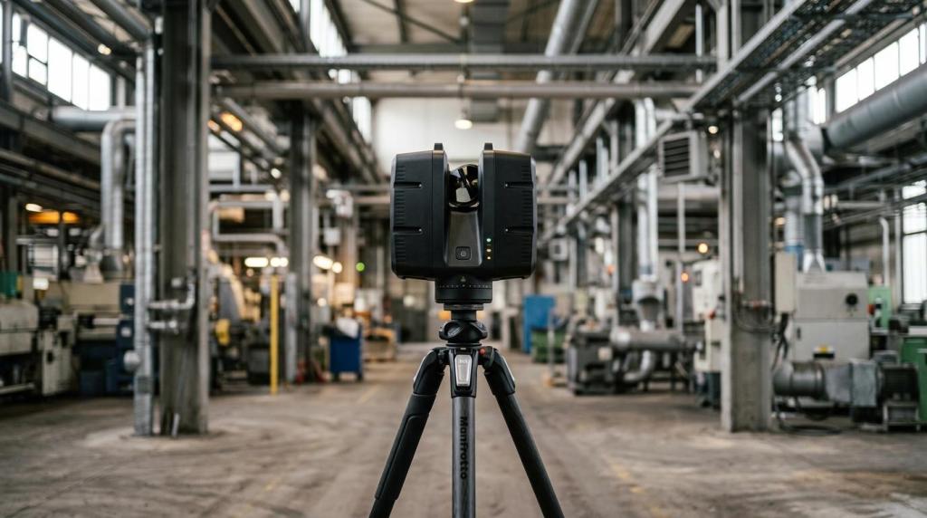
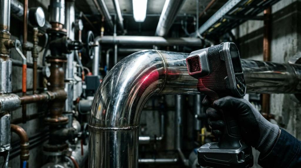
In construction today, fast input data is no longer enough. Increasingly, it also needs to be accurate, up to date and easy to use in the following stages of a project. This is exactly why 3D laser scanners for construction are moving into the spotlight for architects, designers, construction companies and facility managers.
When a complex building is measured by hand, there is pressure on time, coordination and the checking of details. LiDAR and 3D scanning change this process significantly. Instead of individual measured values, you get a dense point cloud in a 3D coordinate system that can be processed further in CAD and BIM environments. The result is a more accurate capture of existing conditions and less room for guesswork on site and in the office.
How construction 3D scanners work when surveying buildings
A construction 3D scanner emits laser beams and evaluates their reflection from surfaces in space. The large number of measured points creates a digital image of the building that captures the geometry of walls, ceilings, openings, building services and structural details. The great advantage of LiDAR scanners is the speed of data capture and the ability to cover large spaces without lengthy manual supplementary measurements.
What matters in construction practice is that scanning does not just create a visual model. Above all, it produces survey data that can be converted into 2D documentation, a 3D model or BIM input. This is essential for building documentation, renovations, as-built verification and the preparation of production documentation.
From a designer's point of view, this is a change that saves time several times over: during the survey, during modelling and during coordination between disciplines.
Key benefits of construction 3D scanners for building documentation
The biggest benefit shows where the actual condition differs from the original documentation, or where documentation is missing entirely. This is common with older buildings, industrial sites, historic buildings and conversions that have changed over the years without a consistent digital record. Scanning makes it possible to obtain reliable input data in a short time and without repeated site visits.
Accuracy is only one part of the overall value. The other part is continuity in working with the data. When a point cloud is processed correctly, it can serve as the basis for drawings, models and BIM coordination. Much of the manual transcription and rough estimating, which tend to be a source of errors, disappears.
The most frequently valued benefits include:
- fast surveys of even large and intricate spaces without lengthy manual supplementary measurements,
- an accurate record of existing conditions in which every point has its own XYZ coordinates,
- fewer repeat site visits and less guesswork during design,
- data that can be used for drawings, 3D models and BIM coordination,
- less manual transcription and estimating, which tend to be a source of errors.
For larger buildings, it is also very valuable that you can return to the data later without having to re-measure everything on site.
Typical uses of construction 3D scanners in renovation and facility management
Renovation is one of the areas where construction 3D scanners are exceptionally strong. The project is based not on assumptions but on actually measured geometry. This reduces the risk of dimensional discrepancies between the design and the real building. The benefit is clear for fit-outs, layout changes, remediation work, thermal insulation and the modernisation of building services.
Use for building documentation is very practical. For buildings without up-to-date documentation, you can create point clouds, derived floor plans, sections, elevations and 3D models. These are then used for asset management, dealings with authorities, investment planning or preparing further stages of alterations. For cities, municipalities and site managers, this is often the fastest way to turn an analogue or incomplete record into digital form.
There is also strong use in industry. Halls, process equipment, pipe routes, load-bearing structures and machinery tend to be spatially complex, and surveying them by hand is time-consuming. An accurate scan helps considerably when designing new lines, relocating equipment and checking clear handling routes.
Heritage conservation, in turn, values the ability to capture intricate surfaces, irregularities and deviations that are typical of historic buildings.
Comparing the specifications of construction LiDAR scanners
Today's market offers various categories of devices, from lightweight handheld scanners to more powerful systems for longer ranges. The difference lies not only in accuracy, but also in mobility, range of applications and how easily the data gets into further processing.
When comparing devices, however, one thing is important: the accuracy figure alone is not enough. You always need to consider range, environment, device mobility and the effort required for subsequent processing. For an interior survey of an apartment building, a lightweight handheld scanner may be ideal. For an outdoor site or an extensive façade, a device with a longer range makes more sense.
What affects the accuracy of construction 3D scanners
The accuracy of 3D scanning is not determined solely by the specifications of the device itself. Results are also affected by the measurement method, the quality of data registration, the operator's movement, the complexity of the space and on-site conditions. With LiDAR data, the link to reference points and the quality of ground control are particularly sensitive, especially when high confidence in height and position data is required.
Interpreting the data is just as important. A dense point cloud does not automatically mean high-quality output for a project. Value is created only once the data has been properly cleaned, registered, evaluated and transferred into documentation or a model.
The following factors have a major influence on the final quality:
- scanner specifications, i.e. accuracy, range and point capture rate,
- the measurement method and the operator's movement during scanning,
- the complexity of the space and on-site conditions, including the reflectivity of the measured surfaces,
- the link to reference points and the quality of ground control,
- the quality of registration, cleaning and evaluation of the point cloud.
That is why it makes sense to see scanning as a process, not just a one-off act of data capture.
Using the point cloud in BIM and CAD documentation
One of the greatest strengths of construction 3D scanning is its link to digital design. A point cloud can become the basis for a model in Revit, AutoCAD or Archicad, or in other CAD software depending on the nature of the project. This moves 3D scanning from a surveying discipline into everyday design practice.
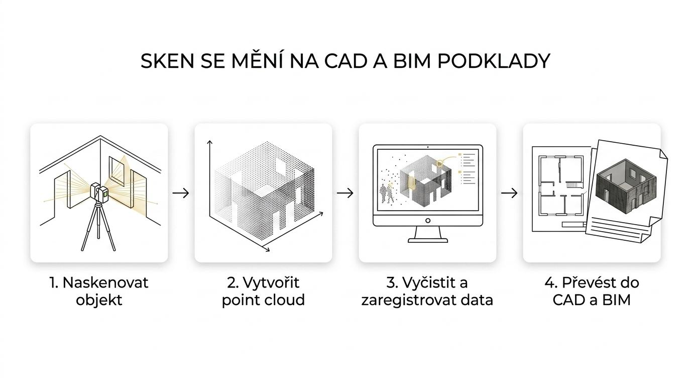
For architects, the advantage is that they can model on top of the condition that was actually captured. For building services engineers, the ability to verify spaces, slopes, passages and clashes is valuable. For investors and facility managers, it is important that the data is not locked into one format but can be used in further stages of the building's life cycle.
In practice, an approach that goes from scan to finished BIM and CAD deliverables is gaining ground. This means not only measurement but also conversion into 2D drawings, 3D models and building records. Specialised providers commonly offer compatibility with Revit, AutoCAD and Archicad, which significantly shortens the time between field data capture and actual use in the project.
That is exactly the moment when a technical survey becomes a productive working basis.
How to choose a 3D laser scanner for construction for your operation
The choice of the right solution should be based mainly on the type of buildings the company measures most often. Family houses and interiors call for a different approach than industrial halls, linear structures or outdoor sites. It also matters whether the company will only capture data or also wants to convert it into drawings and models itself.
It is also worth considering the human factor. A scanner may have excellent specifications, but if it is too heavy, complicated to operate or demanding to process, its potential will not be fully used in everyday operation.
When choosing, it pays to compare these areas in particular:
- the type of buildings: for building documentation and interiors, mobile SLAM scanners (such as FJD Trion X1 or P2) are a good fit; for façades and exteriors, devices with a longer range (the S2 series),
- range, accuracy and data capture speed in relation to your typical projects,
- weight and ease of use in everyday operation,
- GNSS integration with RTK if you need to measure directly in a national coordinate system such as the Czech S-JTSK,
- the option of mobile and tripod-based scanning with a single device (FJD Trion T1),
- compatibility with software for processing point clouds and exporting to CAD and BIM.
If a company handles such projects only occasionally, it often makes sense to start with a scanning and data processing service. Once the need recurs and the data is part of several projects a month, owning the equipment becomes economically very attractive.
Outputs from construction 3D scanning for design and production
Well-executed scanning does not end with a point cloud. A valuable output is one that can be used immediately. In practice, this most often means 2D as-built drawings, 3D building models, BIM input data, documentation for building records or data for checking construction work. Each of these outputs has a different audience, but they all rest on the same foundation: accurately captured reality.
This is why construction 3D scanners are gaining ground across industries. It is not just about modern technology, but about a way of working that brings greater certainty in design, fewer corrections on site and better continuity between surveying, design and construction.
Anyone who needs to work with existing conditions without unnecessary guesswork will find 3D scanning a very powerful tool for everyday decision-making.