
Cart (
0
)
No items found.
Go to pricingProduct is not available in this quantity.
Upload photos from a drone flight and PointLab calculates a textured 3D model, a colour point cloud, an orthophoto and digital surface and terrain models. Processing runs in the cloud on a GPU server — no installation and no powerful computer. Every result comes with an accuracy report.
Free for everyone until 30 November 2026 — a trial period before the official launch.
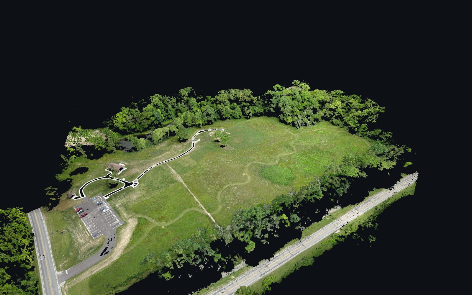
Colour point cloud from 77 drone photos. Data: public OpenDroneMap “Aukerman” dataset, CC0.
JPG, PNG or TIFF, up to 1,500 photos of up to 120 MB each. Drag and drop the whole folder; image positions from EXIF appear on the map before processing starts. Interrupted uploads resume.
Fast preview, Standard, or High accuracy for buildings. Set the photo position accuracy (standard GPS or RTK) and, optionally, ground control points. You see the estimated time in advance.
3D model, point cloud, orthophoto, DSM, DTM and PDF report. Processing runs in the cloud — results arrive even after you close the page.
GLB and OBJ with textures for CAD, BIM and the web. In the model viewer, measure distances, switch to top view or go full screen.
LAZ in project coordinates. Open it in the point cloud viewer and classify it further in the Buildings, Forestry or Corridors modules.
A measurable aerial map as GeoTIFF; the orthophoto and image positions are also shown on the map.
DSM with buildings and trees and DTM of the bare ground, both as GeoTIFF.
Photos used, ground sampling distance (GSD), reprojection error, tie points, deviation from GPS or ground control points (RMSE), coordinate system and scale.
A GCP file in OpenDroneMap format improves absolute positioning. The model is created even without GPS or ground control points — you then set the scale after export.
Every job includes a quality table: how many photos were used, ground resolution, reprojection error and deviation from GPS. Without ground control points, absolute positioning is as accurate as the drone's GPS, but the model dimensions are correct.
Test: synthetic house 10 × 8 m, 73 photos, 5 ground control points; public OpenDroneMap “Aukerman” dataset.
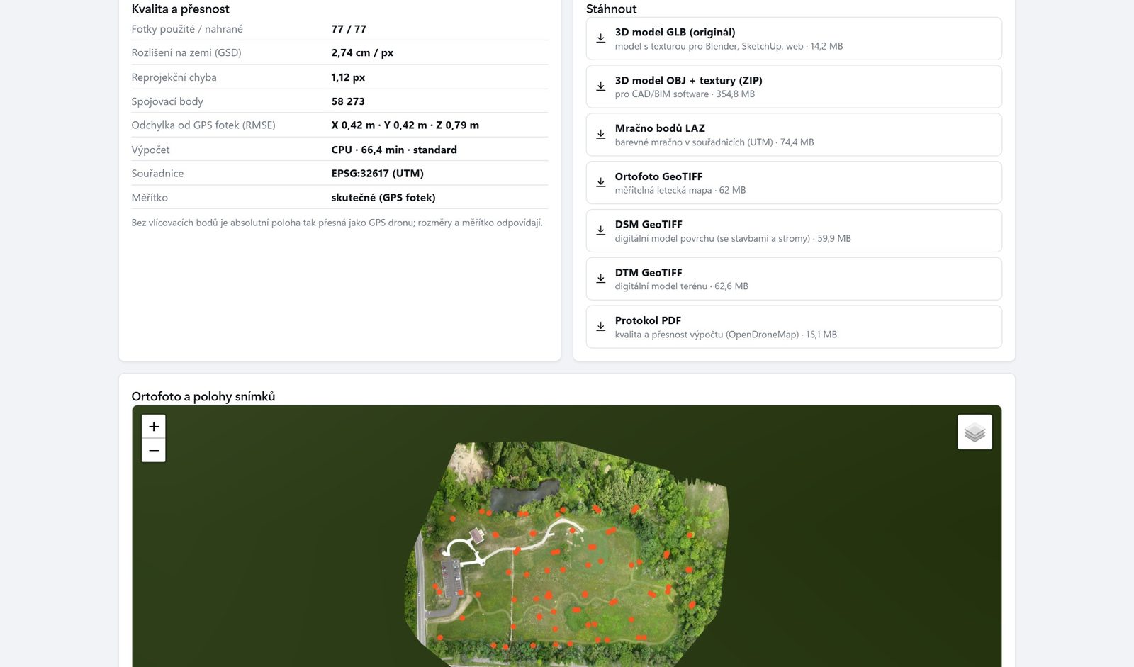
Processing quality and accuracy, and files to download. Data: OpenDroneMap “Aukerman”, CC0.
None. PointLab runs in Chrome, Edge or Firefox and processing takes place on a server in the EU, so you don't need a powerful computer.
It processes up to 1,500 photos, each up to 120 MB. For a 3D model of a house, we recommend orbit flights at two heights with an oblique camera (45°) plus a nadir flight, with 70–80% overlap.
Photogrammetry gives you a colour textured model and an orthophoto from a standard drone. LiDAR also measures the terrain under vegetation and tree stems. PointLab handles both — you classify point clouds from photos and from a laser scanner in the same modules.
Not necessarily. Without them, absolute positioning is as accurate as the drone's GPS and the dimensions are correct. Ground control points (GCP) or an RTK drone improve positioning; on the test house, the deviation was 2 cm over 10 m.
3D model as GLB and OBJ with textures, colour point cloud as LAZ, orthophoto, DSM and DTM as GeoTIFF, and the accuracy report as PDF.
On GPU servers in the EU (Warsaw or Paris); if no GPU is available, processing runs on CPU. Before processing, you can turn on blurring of faces and licence plates: the app finds and blurs them in the photos, and the 3D model, orthophoto and point cloud are created from the blurred photos. Automatic detection may not find absolutely everything (very small, hidden or angled faces and plates).
Every tree with height, DBH, crown and volume, volume per hectare and a stand map.
Forest inventory →Power line protection zones, railway clearance gauges, road slopes and road asset inventory.
Corridors and mapping →Building point cloud classification for scan to BIM, machine layouts and IFC models.
Buildings and interiors →All four modules, storage-based plans and verified accuracy in one place.
4CAD PointLab →We offer 3D scanning services in the Czech Republic, Slovakia, Poland, Austria and Germany. We come on site, capture the data you need and use PointLab to prepare the output you need — a classified point cloud, a floor plan, a forest inventory, a power line inventory or a drone model. No need to buy a scanner or software.
Tell us the location, scope and output you need — we'll get back to you within 24–48 hours. More about the service on our Drone mapping services page.
We will be happy to advise you and call you back.
Leave us your contact details and our sales representative will get in touch as soon as possible to explain everything in detail.
PointLab is free for all users until 30 November 2026 — a trial period before the official launch. The plans below apply from 1 December 2026.
All plans include all four modules. The plan sets the storage for uploaded data and the number of users; additional users can be purchased.
As a guide: 1 GB of LAZ corresponds to roughly 25–40 million points, a 20-minute handheld scan takes 0.5–1.5 GB and a drone scan of one hectare of forest 0.2–0.5 GB. Tell us what data you work with and we'll prepare a quote.
Create your account and upload your own point cloud or drone photos. Want to go through the results with us? Book a demo.
Lukáš Tisoň · 3D scanner sales · +420 735 084 982 · lukas.tison@4-cad.cz
Don't have your own scanner? We'll scan it for you — Czech Republic, Slovakia, Poland, Austria, Germany