
Cart (
0
)
No items found.
Go to pricingProduct is not available in this quantity.
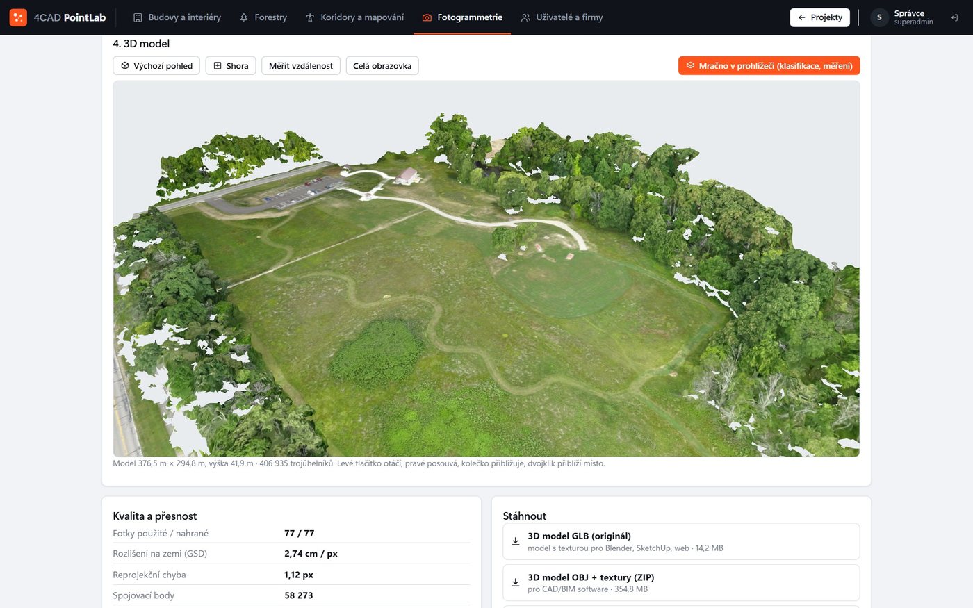
We fly the area with a drone and use 4CAD PointLab to compute a textured 3D model, a colour point cloud, an orthophoto and surface and terrain models (DSM, DTM) from the photos – including an accuracy report.
We scan in: Czechia · Slovakia · Poland · Austria · Germany · data processed in 4CAD PointLab
What we map
For contractors, designers, municipalities and site managers.
Sites and buildings
Textured model of the site and its buildings.
Construction sites
The current state of the construction from a drone flight.
Landscape and terrain
Orthophoto and surface and terrain models.
Privacy protection
Faces and licence plates in the photos can optionally be blurred.
Deliverables
You can further classify the photo-based point cloud in the other PointLab modules.
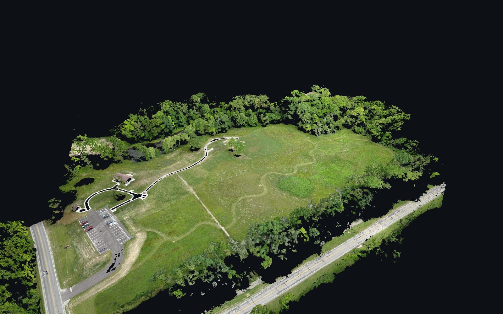
Textured 3D model and colour point cloud computed from photos.
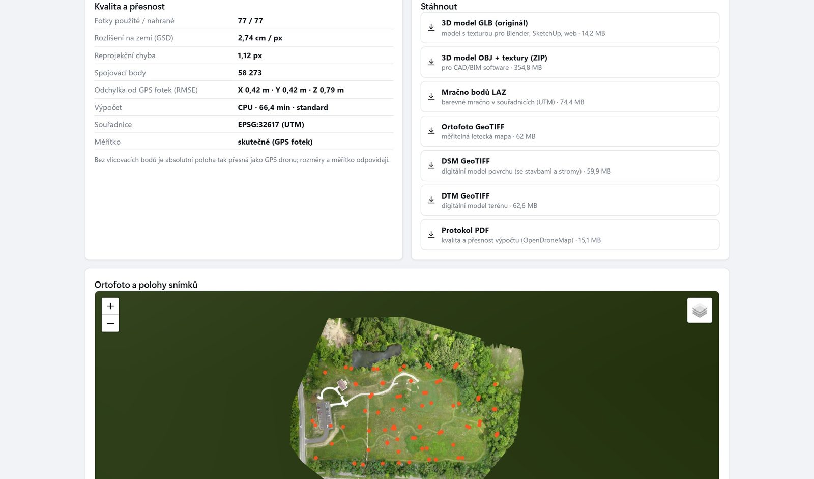
An accuracy report with every processing run.
Process
01
Tell us what you need surveyed and what you will use the result for. We recommend an approach and prepare a quote.
02
We come to you and capture the data you need – without you having to buy a scanner or software.
03
We process the data in 4CAD PointLab and deliver the output in the format you work with.
Analyse the data yourself
In the Photogrammetry module you compute a 3D model, orthophoto, DSM and DTM from your own drone photos – in the browser, with processing in the EU.
Price and lead time
The price depends on the size of the area or building, the level of detail required and the deliverables. Send us your brief and we will prepare a no-obligation quote.
FAQ
Photogrammetry gives you a colour textured model and an orthophoto from a standard drone. LiDAR also measures the terrain under vegetation and tree stems.
Textured 3D model, colour point cloud, orthophoto, DSM and DTM with an accuracy report.
The price depends on the scope, the level of detail required and the deliverables. Send us your brief and we will prepare a no-obligation quote.
We work in Czechia, Slovakia, Poland, Austria and Germany. We come on site and capture the data.
Send us the location and area. We will prepare a no-obligation quote.
We will be happy to advise you and call you back.
Leave us your contact details and our sales representative will get in touch as soon as possible to explain everything in detail.