
Cart (
0
)
No items found.
Go to pricingProduct is not available in this quantity.
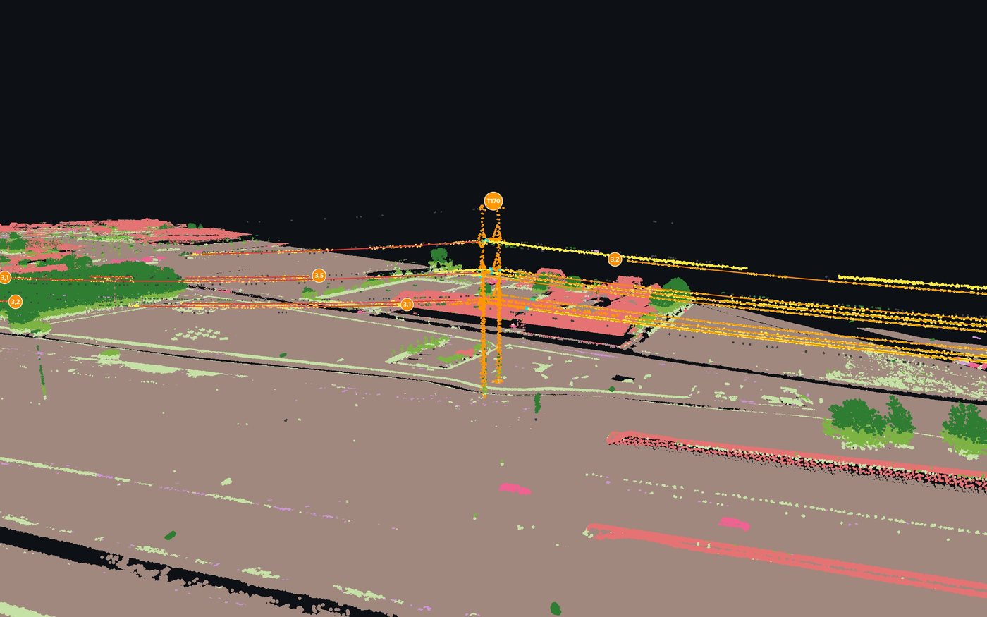
We scan the route and use 4CAD PointLab to assess vegetation encroaching on the power line right-of-way, conductor sag, the rail clearance gauge, road slopes, vertical clearances and a street furniture inventory.
We scan in: Czechia · Slovakia · Poland · Austria · Germany · data processed in 4CAD PointLab
What we survey
For utilities, railway and road operators, cities and municipalities.
Power lines
Conductors and towers, spans with sag, vegetation encroachment and the right-of-way.
Railway track
Clearance gauge and the track surroundings.
Roads
Road surface slopes and vertical clearances.
Cities
Inventory of poles, street lights, signs and other street furniture.
Deliverables
We process large areas in tiles.
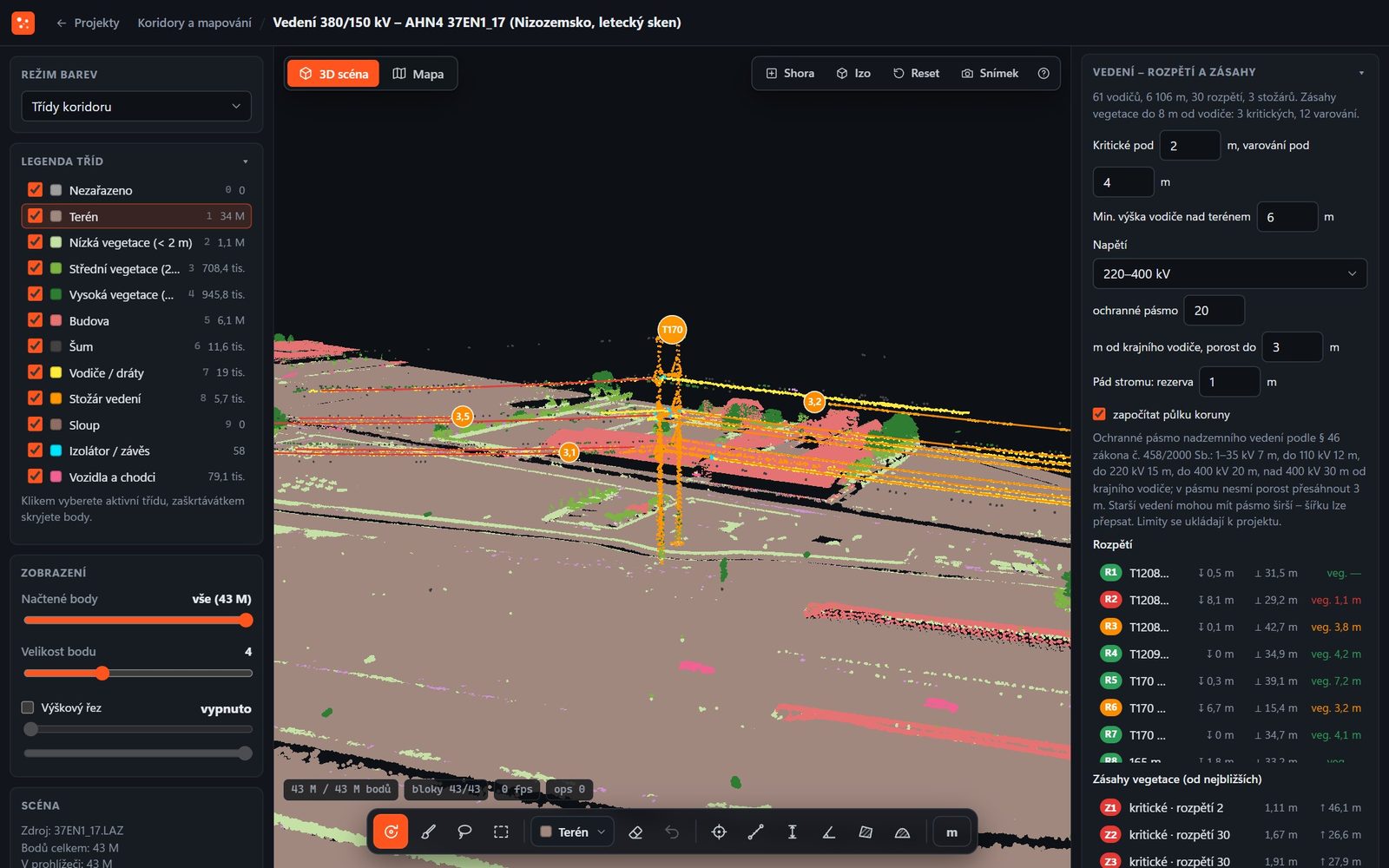
Places where vegetation encroaches on the right-of-way, shown clearly in the point cloud and in a list.
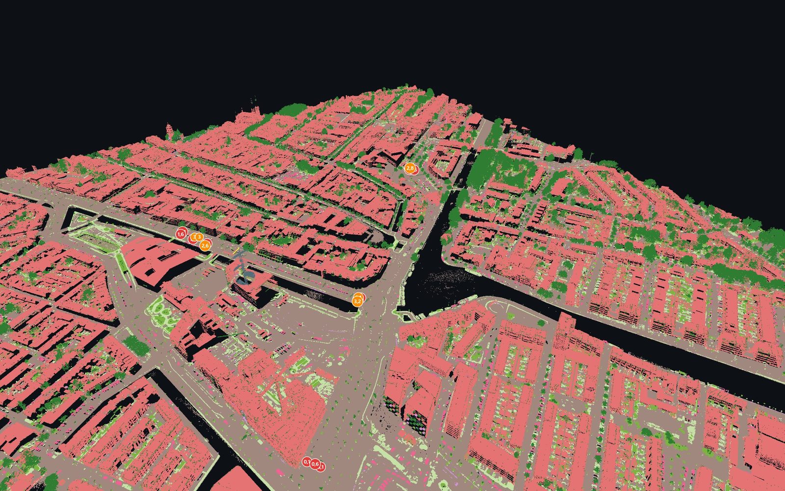
Buildings, vegetation, roads and street furniture distinguished in the point cloud.
Process
01
Tell us what you need surveyed and what you will use the result for. We recommend an approach and prepare a quote.
02
We come to you and capture the data you need – without you having to buy a scanner or software.
03
We process the data in 4CAD PointLab and deliver the output in the format you work with.
Analyse the data yourself
In the Corridors and mapping module you assess power lines, railways, roads and cities – from airborne, drone and mobile scans.
Price and lead time
The price depends on the size of the area or building, the level of detail required and the deliverables. Send us your brief and we will prepare a no-obligation quote.
FAQ
Airborne, drone and mobile scans. We process extensive areas in tiles.
Conductors and towers, spans with sag, vegetation encroachment and the right-of-way.
The price depends on the scope, the level of detail required and the deliverables. Send us your brief and we will prepare a no-obligation quote.
We work in Czechia, Slovakia, Poland, Austria and Germany. We come on site and capture the data.
Send us the length and type of the route. We will prepare a no-obligation quote.
We will be happy to advise you and call you back.
Leave us your contact details and our sales representative will get in touch as soon as possible to explain everything in detail.