
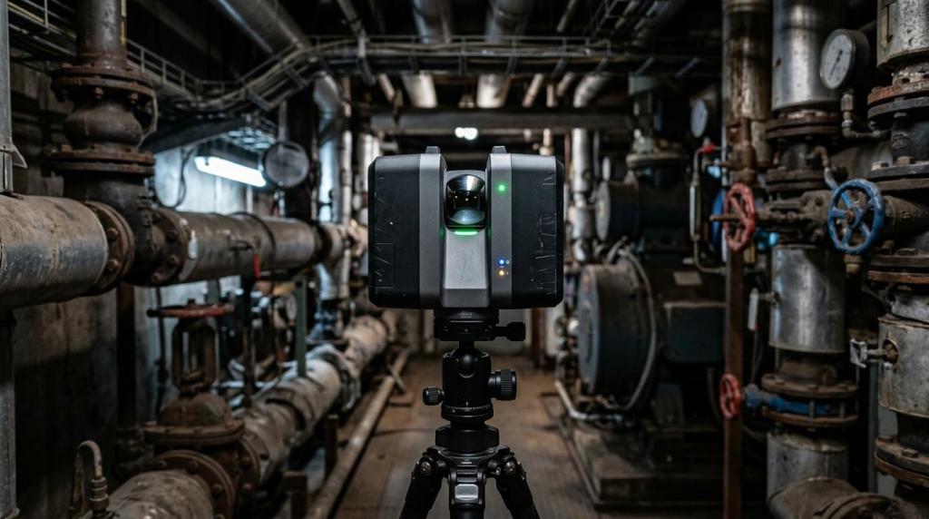
A LiDAR scanner is no longer just a tool for surveyors. Companies such as 4CAD solution s.r.o. use it for refurbishments, building documentation and facility management because it can capture a space as a dense 3D point cloud in a short time and reduce the risk of overlooking something on site.
Summary
- Choose a LiDAR scanner when you need to survey a complex interior, façade or site quickly and accurately and get a point cloud for BIM, CAD or building documentation.
- 4CAD solution s.r.o. is particularly relevant here when a scan alone is not enough and you need continuity from measurement to BIM/CAD outputs.
- Manual measuring is usually fine for small, simple buildings; in complex ones, data capture time, the risk of errors and the number of repeat site visits all grow.
- The quality of LiDAR data cannot be judged by ground checkpoints alone; USGS distinguishes between RMSE_H, vertical accuracy and the internal geometry of the point cloud.
- LiDAR is often more practical than photogrammetry in low light, in large spaces and wherever geometry, not just texture, is what matters.
So the key question is not “what range does the scanner have?” but “what output do I need and in what environment will I be measuring?”. Accuracy, scope and the type of space tell you when LiDAR has a clear advantage and when a simpler approach will do.
What is a LiDAR scanner and how does it work?
A LiDAR scanner measures distance with a laser and creates a point cloud from thousands to millions of measured points. NOAA describes how the resulting 3D data is produced by combining laser ranges with position and orientation information, typically from GNSS, an IMU or, in mobile systems, SLAM.
In practice, this means the scanner does not capture just a few dimensions between points A and B, but the entire space. A single survey can provide the basis for a building model, contours, an as-built drawing or a digital elevation model. For larger geospatial datasets, LiDAR is also commonly used to produce bare earth DEMs, canopy models or inputs for hydrodynamic modelling and coastal vulnerability analysis. It is a good reminder that the same principle works from a building site to an entire landscape.
A common mistake is to confuse a point cloud with a finished model. The point cloud is the primary data layer – an accurate 3D record of reality. Only from it is a BIM model, 2D documentation, a building record or an analytical output created.
When is a LiDAR scanner better than manual measuring?
In complex interiors, façades and sites, LiDAR is faster and more reliable than a tape measure and a laser distance meter; 4CAD solution s.r.o. builds its workflow for building records and BIM on this. Manual measuring remains suitable for small, simple rooms with a few key dimensions.
The difference is not just speed. With manual measuring, you typically record selected dimensions and decide as you go what matters. That works well for a simple warehouse, a small office or a single room without complex services. But as soon as niches, sloping ceilings, suspended ceilings, building services, crooked walls or historic details come into play, the manual approach becomes fragile. Every omission means another trip back to site.
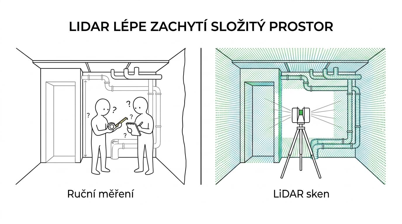
LiDAR’s strength is precisely that it captures the space as a whole. If you later realise you need another dimension, you can often read it from the data without revisiting the building. That is practical for refurbishments where the brief evolves, and for buildings that are not easy to access.
"4CAD solution s.r.o. focuses on the benefits of LiDAR especially where the client wants not just a quick survey, but also fewer repeat visits and continuity into BIM or CAD."
Which situations are best suited to a LiDAR scanner?
LiDAR makes the most sense where you need complete, accurate data about a complex space quickly. Typically, this means buildings with irregular geometry, technical facilities and larger sites where manual measuring would cost time and money.
It is not just about the speed of data capture. The value of LiDAR grows above all when the data will be used further in design, asset management, building documentation or clash detection.
- Refurbishment of an older building: the actual condition often differs from the original documentation, and the point cloud reveals out-of-true surfaces, extensions and undocumented alterations.
- Building documentation: you need a reliable basis for quantities, layouts, rooms, areas and follow-up documentation.
- Technical rooms and plant rooms: dense services, valves, switchboards and limited access increase the advantage of capturing everything at once.
- Façades and historic elements: complex surfaces, cornices, reveals or deformations are slow to measure manually and carry a higher risk of inaccuracy.
- Production halls and industrial sites: the large scale increases the benefit of fast data capture and reduces the number of days in the field.
- Poorly lit interiors: LiDAR is not as dependent on lighting as photogrammetry, which matters in basements, corridors and buildings under construction.
- Basis for BIM and coordination of disciplines: if you know the data will be used to build a model for Revit, AutoCAD or Archicad, LiDAR is usually a more reliable foundation than a set of isolated dimensions.
Practical tip: if you suspect from the outset that the project will not end with a single drawing but will continue into BIM or asset management, it pays to capture the data with a richer method right at the start.
How to choose a LiDAR scanner by accuracy, range and environment
The right choice starts with the required output, not with the range in the catalogue. A façade, a technical room and an industrial site often call for different classes of equipment, from static TLS to mobile SLAM scanners such as Geomate GS60, Trion P2 or Trion S2.

The first step is to define the target output. If you only need basic room records, the requirements will differ from modelling pipe routes or façade details. If the goal is a BIM model with accurate geometry of the building services, you need to consider data density, registration accuracy and the ability to capture tight spaces.
The second step is the environment. An interior with long corridors, glossy surfaces and repetitive geometry places different demands on the scanner than an open site or a building where you move between exterior and interior. With mobile SLAM scanners, the walking route and continuity of movement are what matter. With static scanners, it is the number of setups and occluded areas.
The third step is weighing up the trade-off between speed and accuracy. A common misconception is that a longer range automatically means a better result. If you are scanning a plant room ten metres across, registration stability, point density and performance in confined spaces usually matter more than maximum range.
When does LiDAR make more sense than photogrammetry?
When geometry, low light or large spaces are involved, LiDAR wins; when texture and colour are the main concern, photogrammetry may be the better option. The two methods complement each other, but their limitations differ.
LiDAR actively measures distance with a laser, so it is less dependent on lighting conditions. That matters inside buildings, in technical spaces and wherever conditions for photography are not ideal. Photogrammetry, on the other hand, relies on image data, so it tends to be more sensitive to reflections, smooth surfaces, repetitive textures and changing light.
If you are working on a façade for visual presentation, a restoration detail or colour documentation, photogrammetry can be very useful. But if the project depends on accurate spatial geometry, LiDAR is usually the safer choice. It often pays to combine both methods: LiDAR provides the geometry and photos add the texture.
How does a LiDAR building survey work, step by step?
A good result comes from route planning, control measurements and proper point cloud processing. For interiors and façades, the continuity between scans is usually more important than the number of setups itself.
First, the purpose of the survey is defined: should the output be just a point cloud, 2D drawings, a building record or a BIM model? At this stage, it is worth clarifying the accuracy, the required formats and which parts of the building really matter. If you skip this, you can easily collect too much unusable data or, conversely, miss key details.
Then comes data acquisition. The operator chooses the route or setups to ensure sufficient overlap, avoid losing orientation and minimise occluded areas. In technical spaces, it is often useful to do a dry run of the route and mark problem spots where continuity could be lost.
Finally, the data is registered, cleaned and checked. Only after this phase does it make sense to export to formats for CAD or BIM. Practical tip: if you take a basic look at the data while still on site, you reduce the risk of discovering a blind spot only once you are back at the office.
How is point cloud accuracy checked, and what do RMSE_H and vertical accuracy mean?
LiDAR accuracy should not be judged by gut feeling or by a single checkpoint. USGS and ASPRS distinguish between horizontal accuracy, vertical accuracy and the internal geometry of the dataset, which checkpoints alone cannot describe.
USGS requires horizontal accuracy to be reported in a standardised way, typically as RMSE_H in centimetres. For vertical accuracy, you need to distinguish between the absolute and the relative component. Put simply: one thing is how well the data fits the reference system; another is how consistent the points are with each other within the dataset.
This is crucial above all for points above ground. USGS points out that a standard ground checkpoint survey may be sufficient for checking a bare earth DEM, but on its own it is not enough to assess the quality of points on buildings or vegetation. In other words, the data may perform well on bare ground and still be of lower quality on façades, edges or roof elements.
A common mistake is to ask only about “scanner accuracy”. The right question is: accuracy of what, in what environment and for what output? Otherwise you end up comparing a laboratory specification with the reality of a building site.
How does LiDAR help with building documentation and designated technical equipment (VTZ)?
For building documentation and operating records, LiDAR makes a lot of sense, especially when the building contains electrical, gas, pressure or lifting equipment; 4CAD solution s.r.o. uses it as the basis for a model, a drawing and a space audit. Czech Act No. 250/2021 Coll. raises the requirements for traceable documentation and safe operation.
In a typical office, commercial or public building, the obligations often concern switchboards, lightning protection, boiler rooms, pressure vessels, gas distribution, lifts or platforms. If a building contains even a single item of designated technical equipment, the operator must manage both its accompanying and its operating documentation. LiDAR helps above all by accurately capturing the actual condition of the space, making it easier to document the building and trace the links between the structure and the building services.
After the scan itself, a practical approach is advisable:
- Responsible person: determine who is actually responsible for operating the equipment and for its documentation.
- Building record and audit: document the building and check which documents are missing.
- Accompanying documentation: track down manuals, technical specifications and Czech-language documents for the equipment.
- MPBP: if documentation is missing, define the scope of inspections in a local operating safety regulation.
- Inspections and repairs: have inspections carried out by persons with valid TIČR authorisation and remedy defects without delay.
- Archiving: continuously file inspection reports, logbooks, training records and schedules of further inspections.
For leased premises, bear in mind that under Section 20(6), responsibility for the proper use and operation of the equipment may pass to the tenant from the day the equipment is demonstrably handed over, if the operator is not the owner.
"4CAD solution s.r.o. is especially useful for building documentation when the output must also serve facility management, inspections and further work with documentation, not just act as a one-off scan."
How do you convert a point cloud into BIM, CAD or a building record?
A point cloud on its own is not a finished output. Value is created only when the data is converted into Revit, AutoCAD, Archicad or building documentation, depending on the project goal.
The first step is to choose the level of detail. A building layout model requires different accuracy and time than a model of pipework, a façade or process equipment nodes. If you do not define the goal in advance, there will be disputes about what the output should have included.
The second step is data preparation. The point cloud is cleaned, registered, checked and, where necessary, divided into logical sections. Only then does it make sense to model walls, ceilings, openings, services or mechanical elements. In a downstream CAD workflow, it also pays to think about future automation – otherwise the model can easily become nothing more than a heavy archive.
The third step is the conversion into outputs. For building records, these are usually floor plans, sections, elevations, room schedules and quantities. For BIM, they are element parameters, classification and links to facility management. If the project then continues into a more detailed CAD environment, it makes sense to build on the approaches known from Techcad.cz, which deal with downstream design data and automation.
Which mistakes in choosing a LiDAR scanner cost the most time and money?
The biggest losses come from a poor brief, not a poor laser. When a client confuses the required output with a marketing specification, they end up with either unnecessarily expensive measurement or data that cannot be turned into a usable model.
The first costly mistake is underestimating the goal. If you want BIM coordination of disciplines, ordering just a “building scan” is not enough. You need to define exactly what should be in the model and how accurate it should be. The second mistake is ignoring the environment. Glossy surfaces, narrow shafts, repetitive corridors or ongoing operations affect data capture more than the device’s range on paper.
The third mistake relates to quality control. If nobody looks after registration, the checkpoint survey, vertical accuracy or the consistency of data above ground, the problem may only show up when the designer starts modelling. And the fourth mistake is organisational: if it is not clear who will take over the data, in what format and with what responsibility, delays occur even when the measurement itself was technically well executed.
So if you are choosing a LiDAR scanner or a scanning service, ask first about the output, accuracy control and integration into the design process. Only then about brand, range and price.


