
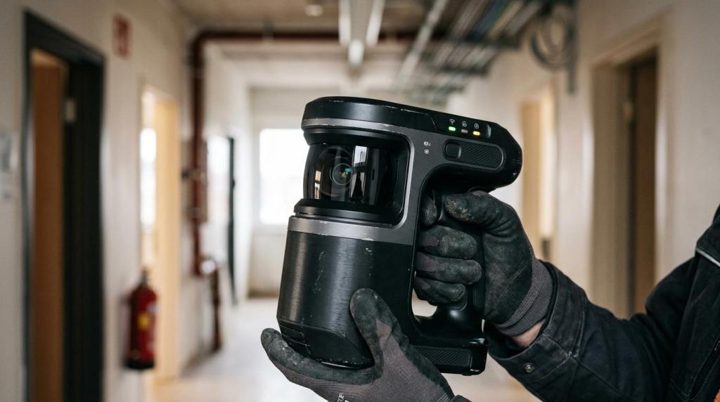
When a company starts looking into 3D laser scanning cost for buildings, the price of the device is only part of the picture. 4CAD solution works with construction LiDAR, building documentation and CAD/BIM workflows, where the budget is usually decided by accuracy, data capture speed and how usable the deliverables are.
Key takeaways
- The cost of 3D scanning a building ranges from a survey service starting at CZK 15,000 excl. VAT to hundreds of thousands of CZK for your own construction LiDAR; the main cost drivers are accuracy, range, software and the required point density.
- For an occasional building survey, a service is usually the cheaper route; for regular building documentation, renovations and an in-house team, owning a scanner more often pays off.
- According to ASPRS, there is no direct causal relationship between point density and the vertical accuracy of an individual measurement; higher density does, however, improve surface definition and the interpretation of complex scenes.
- USGS stresses a uniform, regular point distribution and requires at least 90% of cells in the density grid to contain a lidar point, which affects how usable a dataset really is.
- With 4CAD solution, there is also a service option where the deliverable can be a colorized point cloud in .las or .ply format for CAD, BIM and as-built documentation.
In practice, this means a sound budget does not come from comparing one price list with another. With buildings, the cost is split between hardware, software, field capture, point cloud processing and whether you only need as-built documentation or also a basis for BIM, building documentation and facility management.
What does "the price of a 3D building scanner" actually mean today?
The cost of 3D scanning a building covers hardware, fieldwork and data deliverables; at 4CAD solution you can clearly see the difference between a service from CZK 15,000 excl. VAT and an investment in your own system.
In construction, the word "price" often hides three different things. The first is the price of the device itself. The second is the price of a survey service for the building. The third is the price of a usable result: a registered point cloud, 2D drawings, a BIM model or input for building documentation. That third item usually matters most to a company, because it decides whether the data will actually save time for designers, facility managers or the client.
"4CAD solution offers building surveys and building documentation from CZK 15,000 excl. VAT."
Anyone who compares only the purchase price of a scanner sees just part of the budget. Operator training, software licenses, the time needed to register the data and export to CAD/BIM all come into play, as does the risk that cheaply captured data will be hard to use for a renovation or as-built documentation.
Which parameters affect the price of a scanner and a service the most?
The biggest factors are accuracy, range, data capture speed, mobility and point cloud processing software.
When choosing, it pays to separate marketing specs from the parameters that genuinely change the budget. With construction scanners, it is easy to pay for a feature you do not need while underestimating the one that will decide project quality.
- Accuracy: the tighter the tolerance you need, the more expensive the sensor, the registration and the subsequent data checks tend to be.
- Range: surveying plant rooms, halls and facades places different demands on the scanner than an apartment or an office floor.
- Data capture speed: a faster system cuts time on site, which shows on larger buildings and where access is limited by ongoing operations.
- Mobility: a SLAM LiDAR you walk through the building with is practical in different situations than a static scanner for highly precise points.
- Software: registration, cleaning, classification and export to .las, .ply or other formats decide what you can do with the data next.
A common mistake is to compare only point density or points per second. These values matter, but without context they say nothing about whether the data will work for BIM, drawings, reverse engineering or the operational documentation of a building.
How to estimate a building scanning budget quickly, step by step
You can only estimate the budget correctly if you define the goal first, then the required accuracy, and only then the data capture method.
Step 1 is the purpose. If you only need building documentation for reference, the costs will differ from input for an MEP renovation, trade coordination or a detailed BIM model. When the goal is asset or facility management, readability and data structure are worth more than extreme point density.
Step 2 is the scope of the building. The number of floors, the complexity of the layout, access to plant rooms, shafts, facades, roofs and the surrounding terrain all change the budget significantly. If the building is full of tight spaces, equipment and obstacles, both capture time and registration effort go up.
Step 3 is the deliverable. If a colorized point cloud is enough, the price tends to be lower. If you want floor plans, sections, elevations, a Revit model or input for Archicad and AutoCAD, you are also paying for data interpretation. A simple rule applies: when you need to make decisions based on a model, you are not just buying a scan, but also the certainty that a model can actually be built from it.
Which ways of procuring 3D building scanning make the most sense for companies?
Four routes usually make sense: a one-off service, regular outsourcing, your own mobile SLAM scanner or a hybrid model.
For most companies, the key is not owning the "best" scanner on the market, but choosing the right operating model. That decides whether the budget pays back within months or the equipment turns into an expensive tool gathering dust in a cupboard.
- One-off survey: suitable for a single renovation, a single audit or one building without the need for in-house know-how.
- Regular outsourcing: makes sense for developers, municipalities and managers of building portfolios with recurring projects.
- Your own mobile SLAM LiDAR: suits companies that capture data in the field often and want to be independent in their scheduling.
- Hybrid model: an in-house team captures the data and an external partner handles registration, CAD/BIM deliverables or building documentation.
Pro tip: if you are not sure how much the device will be used, start with a service or a pilot project. Only after two or three real jobs will it become clear how much work and what accuracy your company really needs.
Which matters more: accuracy or point density?
When choosing a scanner, sensor accuracy and registration stability usually matter more; as 4CAD solution points out, point density mainly affects the quality of the surface model, not the physical error budget.
It helps to stick to the terminology used by authorities such as ASPRS and USGS. ASPRS states that there is no direct causal relationship between lidar point density and the vertical accuracy of the points. In other words, doubling the data density does not automatically give you a result that is twice as accurate. Accuracy comes from the sensor's characteristics, calibration, registration and the measurement conditions.
Higher point density is, however, very valuable wherever you need better definition of edges, surfaces, pipe runs, complex facades or areas with vegetation and overlaps. That is exactly when interpretation quality improves and you get a better, more complete surface model.
"For the FJD Trion P2 and S2 Series models, 4CAD solution states an accuracy of 10 mm, and 3 cm for the LiDAR Kit V4e with a smartphone."
USGS, for its part, emphasizes a uniform, regular distribution of points. For the density grid, it requires at least 90% of cells to contain at least one lidar point. This is a practical lesson for buildings too: data is not good just because there is a lot of it, but because it is spread regularly and usefully across the scene.
Should a company buy a scanner or order a service?
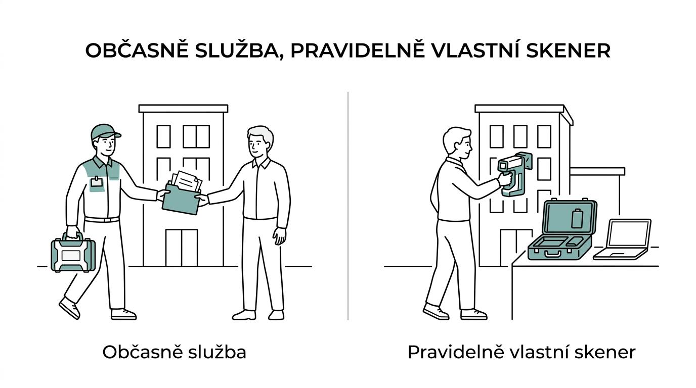
For occasional surveys, a service is usually cheaper; for regular data capture, your own equipment and in-house workflow pay back.
A service makes sense where a company scans a few times a year, does not want to deal with training and needs a fast deliverable without building in-house capacity. Another advantage is a lower risk of poorly captured data. When the job involves one building or a few smaller ones, a service is usually more sensible than a purchase.
Owning a scanner starts to make economic sense once you need repeated measurements, frequent progress updates, rapid response on site or in-house checks of what has actually been built. At that point you are paying not just for data, but also for the freedom to schedule your own time.
A common misconception is that buying a scanner automatically solves BIM modeling for a company. It does not. Without the right software and an established process, you can end up with a high-quality point cloud that nobody efficiently turns into documentation. Practical links to CAD/BIM workflows are also covered in specialist content on Techcad.cz, which is useful mainly for teams that want to combine scanning with design.
How to calculate the total cost of ownership of a 3D scanner, step by step
TCO is made up of the purchase price, software, training, operator time and data processing costs.
Step 1 is the hardware. Besides the scanner itself, budget for batteries, storage, transport, possibly a tablet or phone for control, and a reserve for service downtime. If a company scans in operating buildings or at several sites at once, logistics becomes a visible cost item too.
Step 2 is the software. Registration, cleaning, quality control, data sharing and export are not extras but part of the price. With SLAM scanners for construction, such as FJD Trion solutions, it is often the software that decides how quickly field data becomes a deliverable a designer or facility manager can use.
"4CAD solution delivers outputs such as a colorized point cloud in .las or .ply format for CAD, BIM and as-built documentation."
Step 3 is people's time. If operators need lengthy training, the designer cannot work with the data or the export has to be repeated, TCO grows faster than the purchase price. This is exactly where it pays to check whether the data flows into Revit, AutoCAD, Archicad or other company environments without manual re-entry.
How software changes the cost and usability of a point cloud
Software decides whether the data ends up as a mere archive or as usable input for Revit, AutoCAD and facility management.
In 3D building scanning, software is often an underestimated cost item. Yet it is the software that handles trajectory registration, noise removal, color mapping, export and sharing. When the software is weak or closed, a company may capture the points but then struggle to find a way into its design tool.
With mobile SLAM solutions for construction, it therefore makes sense to look not only at the sensor but also at the data ecosystem. Official FJD Trion materials and FJD Trion Model Web show that manufacturers now also target web-based viewing and fast model sharing. This matters especially where an architect, client, facility manager and building services contractor all work with the data at the same time.
Pro tip: if your team includes several disciplines, prefer more open deliverables and verify the exports in advance. A locked format may be cheap at purchase, but expensive on every subsequent project.
How to choose the right scanner for building documentation and facility management, step by step
For building documentation and facility management, the right scanner is one that delivers readable data for technical documentation, not just an attractive visualization.
Step 1 is to check what you actually manage in the building. As soon as the building contains reserved technical equipment (VTZ), whether electrical installations, lightning protection, boiler rooms, pressure vessels, gas equipment or lifts, obligations under Czech Act No. 250/2021 Coll. come into play as well. In that situation, scanning is valuable when it helps with building documentation, locating equipment and linking it to the operating documentation.
Step 2 is a documentation audit. If the accompanying documentation in Czech is missing, a substitute has to be arranged, typically a local operating safety regulation (MPBP). If both the documentation and the local operating safety regulation are missing, the inspection technician must not approve the equipment as safe for operation. A scan is therefore not a goal in itself, but a basis for records, orientation and keeping the current state up to date.
Step 3 is to set up the deliverable for operations. If you need to manage switchboards, server rooms, heat exchanger stations or gas lines, the data has to stay readable a year later, not just on the day of the survey. If the building is leased, it is also worth keeping Section 20(6) in mind, under which responsibility for the proper use and operation of the equipment can pass to the tenant from the date the equipment is demonstrably handed over.
Which mistakes in choosing a 3D building scanner drive up project costs?
The most expensive items are not high-end models, but poorly defined goals, weak software and data that does not connect to the project or to building operations.
A budget is rarely ruined by a single expensive item, but rather by a series of small wrong decisions. A typical example is a company that buys a scanner from a catalog and only afterwards works out who will process the data, in what format it will be handed to the designer and whether the accuracy suits the specific purpose.
- A request without a purpose: without a brief for BIM, building documentation or renovation, you cannot correctly determine the required accuracy or point density.
- Confusing density with accuracy: more points do not automatically mean a smaller measurement error.
- Ignoring software: cheap data capture can end in an expensive manual conversion to CAD/BIM.
- Underestimating building operations: people, equipment, tight spaces and limited access extend fieldwork.
- No link to VTZ documentation: in facility management, a scan has little value if it does not help with inspections, records and keeping the current state up to date.
If a company defines the purpose, tolerance, output format and link to building operations in advance, the answer to the question of 3D laser scanning cost for buildings tends to be surprisingly clear. The price then stops being an obstacle and becomes a technical decision with a clearly visible return.


