
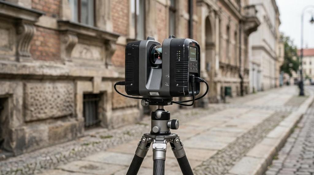
When you are preparing a facade renovation, thermal insulation, window replacement or the refurbishment of an older building, approximate dimensions are not enough. You need a basis that truly shows planes, offsets, cornices, reveals, deformations and the connections to the terrain and surrounding structures.
4CAD solution provides 3D facade scanning as a professional service for architects, designers, developers, facility managers and the public sector. We deliver not just the scan itself but also the follow-up outputs for CAD and BIM, so field data don’t stay “just in the scanner” but go straight into design, building documentation and as-built checks.
3D facade survey by 4CAD for renovation, building documentation and accurate design
4CAD solution helps wherever manual measurement would mean tedious follow-up measuring, repeated site visits and a higher risk of errors. For facades with irregularities, intricate details or a long building frontage, 3D scanning clearly makes sense because you get a more complete and more accurate basis for further design work.
The result is not just a visual model. You get a digital basis for the renovation from which the actual condition of the facade can be read and on which drawings, a BIM model and deviation checks can build.
“4CAD converts facade data into DWG, PDF or IFC, so the design and the BIM workflow can follow on directly from the survey.”
This is particularly important for older buildings, apartment blocks, public buildings, industrial sites or heritage-protected structures, where every inaccurate follow-up measurement makes both design and construction more expensive. That is why 4CAD builds its 3D facade scanning service on continuity – from data capture all the way to outputs the design team can actually use.
Georeferenced facade survey for architects, designers, developers and facility managers
If you are designing a renovation of the building envelope, replacing windows and doors, planning new cladding or need as-built documentation, you need data that several disciplines can read at once. 4CAD prepares a georeferenced point cloud, so the facade is not an isolated cut-out without context but part of the building, the terrain and the surrounding elements.
For developers and investors, this means a better basis for project preparation and fewer ambiguities during coordination. For facility management and site managers, it is often the first step towards more accurate building documentation or updating the records before a renovation.
“4CAD captures facades, roofs, terrain and surrounding elements with georeferencing for one shared basis.”
For larger buildings, georeferencing is a real practical advantage. It makes it easier to link up with the site plan, other disciplines and future project phases, without having to piece together several incompatible data sets.
3D facade scanning outputs for Revit, AutoCAD, Archicad and Scan-to-BIM
4CAD solution delivers a dense point cloud with colour information and precise coordinates. This gives you better legibility of facade details and less reliance on manual follow-up measuring, which in renovations is often a source of inaccuracies and later extra work.
“4CAD delivers a dense point cloud with colour information and precise coordinates, compatible with Revit, AutoCAD and Archicad.”
Depending on the purpose of the job, we prepare outputs so that they can be used in the next design step, not just archived. Most often we follow up in these forms:
- Georeferenced point cloud: for accurate documentation of the facade, roof, terrain and surroundings.
- Elevations, sections and floor plans in DWG or PDF: for the renovation design, building documentation or as-built checks.
- IFC and follow-up BIM data: for the Scan-to-BIM workflow and coordination in the digital building model.
Thanks to compatibility with Revit, AutoCAD and Archicad, you don’t have to laboriously convert data between the tools your team already uses. In this way, 4CAD shortens the path from the survey on site to the designer’s work in the office.
How 4CAD carries out a 3D facade survey without unnecessary return visits
We plan every survey according to the character of the building, the required accuracy and the resolution of the resulting 3D model. 4CAD does not apply one universal procedure but adapts the technology to whether you are dealing with a family house, an office building, a production hall, an urban building or a historic facade with intricate details.
We work with modern LiDAR technologies, and the 4CAD portfolio also includes FJD Trion 3D scanners. What matters to you is that we choose a data capture method that matches what the result should be, not just what is technically possible to capture.
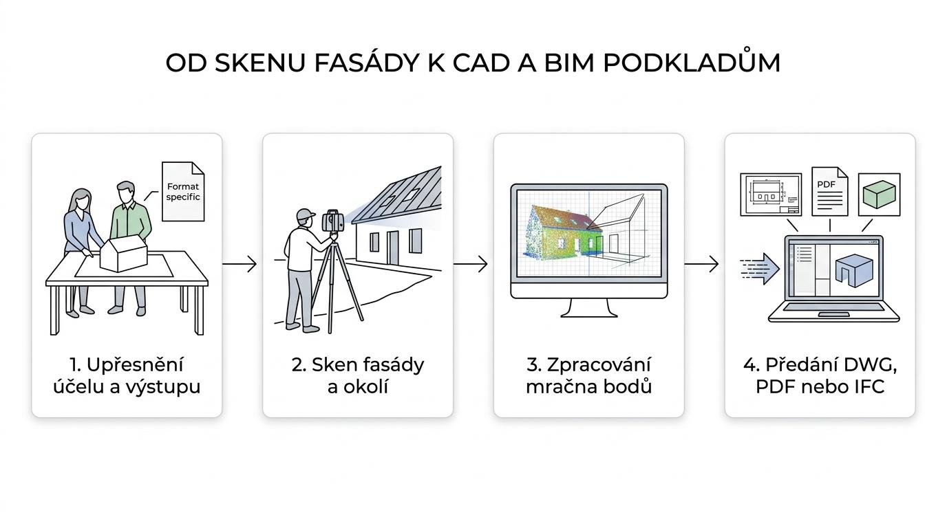
A typical project runs like this:
- We clarify the purpose of the survey, the required accuracy and the output format.
- We scan the facade and, if needed, the roof, terrain and surrounding elements.
- We process the point cloud and georeferencing and prepare the follow-up CAD or BIM data.
- We hand over the data in a format you can use directly in design, the building record or construction coordination.
This procedure reduces the risk of discovering a missing dimension or an unclear detail weeks later. When 4CAD prepares the output correctly from the start, your team has a solid basis for further decisions, budgets and communication with the contractor.
When is 3D facade scanning the best choice for your building?
Not every building needs the same amount of data. 4CAD recommends 3D facade scanning above all where the accuracy of the basis has a major impact on the design, the cost and the course of the renovation.
Typically, these are the following situations:
- older buildings with unevenness, historical alterations or incomplete documentation
- long or tall facades where manual measurement is slow and error-prone
- renovations requiring accurate elevations, sections and BIM data
- sites and buildings where the roof, terrain and links to the surroundings also need to be captured
- building documentation for asset management, design preparation or further refurbishment phases
For historic buildings and intricate upper parts of facades, it is important to define the scanning scope and the expected output correctly in advance. That is why 4CAD works through the brief with you in practical terms, so that the data match what you really need to design, get approved or document.
Why 4CAD is a strong choice for building renovation and documentation in the Czech Republic
4CAD solution combines certified experts in CAD, design automation and 3D technologies with real data delivery for construction practice. For you, this means one partner for the survey, processing and conversion into outputs that can be used in standard design tools and in facility management.
Unlike a pure surveying service, we can follow on with BIM, CAD and other digital processes. In this way, 4CAD helps you not only obtain data on the facade but, above all, speed up design, make better-informed decisions and reduce manual work when redrawing documents.
If you are dealing with broader documentation of a building, we can also follow on with related services for 3D scanning of buildings and digitisation of documentation. You can find more on related topics on Techcad.cz or on our page dedicated to building documentation.
Book a facade survey for your specific project
If you need an accurate basis for a facade renovation, the refurbishment of an older building, building documentation or conversion to BIM, contact 4CAD solution. Describe the building, the required output and the deadline, and we will propose a suitable scope of 3D facade scanning and the follow-up CAD/BIM processing.
The sooner you have accurate data on the actual condition, the more confidently you can decide on the design, the budget and the next steps of construction.


