
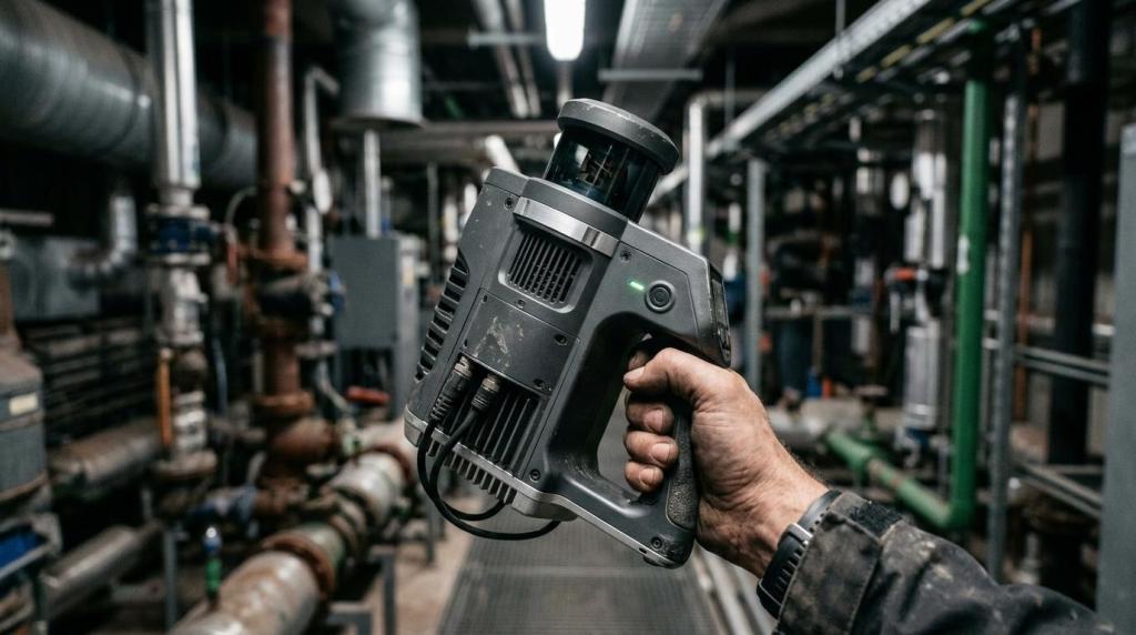
In just a few minutes, a phone can create an impressive 3D model, measure a room or capture a small object for further work. That is great news for architects, designers, facility managers and field technicians. At the same time, an impressive result on the screen does not necessarily mean data suitable for documentation, BIM or accurate decisions on site.
This is where it pays to distinguish between a quick indicative scan and professional measurement. A phone is an excellent helper when you need to record the current state quickly, prepare material for a discussion or support your workflow. But as soon as accuracy, longer range, repeatability and integration with CAD or BIM come into play, the limits of a phone show up very quickly.
How 3D scanning with a phone works in practice
The term 3D scanning with a phone often covers three different methods. Each has different capabilities, different accuracy and a different type of output. If you do not distinguish between them right at the start, expectations become unnecessarily high.
A phone can work with the camera alone, with the camera plus depth calculation or – on selected devices – with a built-in LiDAR sensor. The result can then be a simple distance measurement, a 3D mesh of a smaller object or a spatial model of a room.
From a technical point of view, you will most often come across these options:
- AR measuring: quick reading of dimensions in an app, suitable for rough checks
- Photogrammetry: a 3D model built from a larger number of photos, heavily dependent on lighting, surface texture and processing quality
- Phone LiDAR scanner: better depth handling at close range, but still mainly for smaller scenes and approximate data
- Scanning apps: combine video, photos and algorithms to reconstruct the space
For measuring with a phone, Apple states that for best results the object should be roughly 0.5 to 3 metres from the phone and that the measured values are approximate only. That is a very important note. The manufacturer itself makes it clear that phone measurement is no substitute for surveying equipment or professional scanning gear.
When 3D scanning with a phone is really enough
In many situations, a phone is surprisingly useful. If you do not need millimetre accuracy and mainly care about speed, availability and low cost, mobile scanning can be a sensible choice.
It works well when you want to quickly capture a smaller object, roughly estimate dimensions, check spatial relationships or prepare for a follow-up visit. Typical examples are an initial interior survey, a client consultation or smaller items for visualisation.
A phone also delivers very good results with smaller, stable, well-lit objects that have a distinct texture. Academic studies on close-range photogrammetry show that, with the right procedure, very decent results can be achieved for some scenes. For small models and stable geometries, surface deviations of tenths of a millimetre have even been reported. But that does not mean you will get the same quality in a plant room, on a façade or in the long corridor of an office building.
A phone makes sense mainly in these cases:
- quick survey of a space
- rough measurement of a room
- documenting a smaller object
- material for a discussion with the designer
- reference before accurate measurement
- visual record of changes during construction
The difference between “good enough” and “not good enough” usually does not show in how the model looks, but in what you want to do with it next.
Accuracy of 3D scanning with a phone – and why it varies so much
With mobile scanning, accuracy varies much more than with dedicated scanners. It depends on the device, the app, the quality of the optics, lighting, distance from the object, surface gloss, the amount of detail in the scene and the operator’s experience.
In studies focused on smartphone photogrammetry, accuracy varied significantly from phone to phone. In one expert comparison, the mean RMSE of 3D coordinates was around 2.6 cm, and around 1.5 cm after distortion correction. When shooting from a distance of 11 metres, the maximum estimated error was approximately 3.0 cm, or 2.2 cm after accounting for distortion. That is usable for quick indicative work, but often not for detailed design documentation.
The scene itself also has a big impact. A phone copes better with a small object on a table than with a long corridor without distinct reference points. Results tend to be worse on plain walls, glass, glossy surfaces and dark materials, or wherever people are moving around.
A simple comparison can help you decide quickly:
| Task | Is a phone enough? | What to expect from the result | Better alternative |
|---|---|---|---|
| Rough measurement of furniture or an alcove | Yes | Approximate dimensions | Not needed |
| Smaller object for a 3D model from photos | Yes, often very well | Depends on lighting and texture | Desktop scanner if higher accuracy is needed |
| One room as a quick reference | Mostly yes | Usable for design and communication | SLAM scanner if the output goes into BIM |
| Whole flat or floor | Only to a limited extent | Risk of accumulated errors | Mobile SLAM LiDAR |
| Plant room, technical room, building services | Mostly no | Weaker with details and clashes | Professional 3D scanner |
| Façade, hall, site | No | Short range, less stable data | SLAM or terrestrial scanner |
Accumulated error is a common problem. Individual measurements may look acceptable, but over a larger area or a longer route the deviations add up. The result does not look dramatically wrong, but the inaccuracy becomes apparent during modelling, installation or when checking how elements connect.
When a phone is not enough for buildings, BIM and facility management
As soon as an indicative record becomes the basis for a design, construction or building operation, the requirements change. It is not enough for the model to “roughly fit”. You need certainty that dimensions, plumbness, structural connections and the position of building services match reality.
In buildings and technical spaces, the issue is often not just geometry but also equipment documentation. This is especially important for building documentation and facility management, where a building may contain designated technical equipment (VTZ). Czech Act No. 250/2021 Coll. tightened operators’ obligations regarding documentation and the safe operation of VTZ. So if survey outputs serve as the basis for equipment records, operating documentation, inspections or repair planning, an indicative phone scan is usually not enough.
In practice, a phone mainly runs into these limits:
- Higher accuracy: when you need a reliable basis for CAD, BIM, manufacturing or installation
- Longer range: larger halls, façades, roads, sites and complex exteriors
- Fine details: pipes, valves, switchboards, cable routes, structural connections
- Repeatability: situations where the measurement must stand up to a later check
- Data stability: poorly lit spaces, monotonous surfaces, glass, metal and glossy materials
A typical case is a technical room where electrical systems, HVAC, heating and control instrumentation meet. A phone can be useful here for quick photos, notes and a rough overview. But if you need to resolve clashes, prepare a refurbishment or create a credible record of the building services, you need a more accurate method.
Phone vs. SLAM LiDAR scanner for construction
This is where the difference becomes very clear. A dedicated construction laser scanner is designed to capture spatial data, not just to produce a visually impressive output. What matters is range, point cloud density, accuracy, stability while moving and integration with other software.
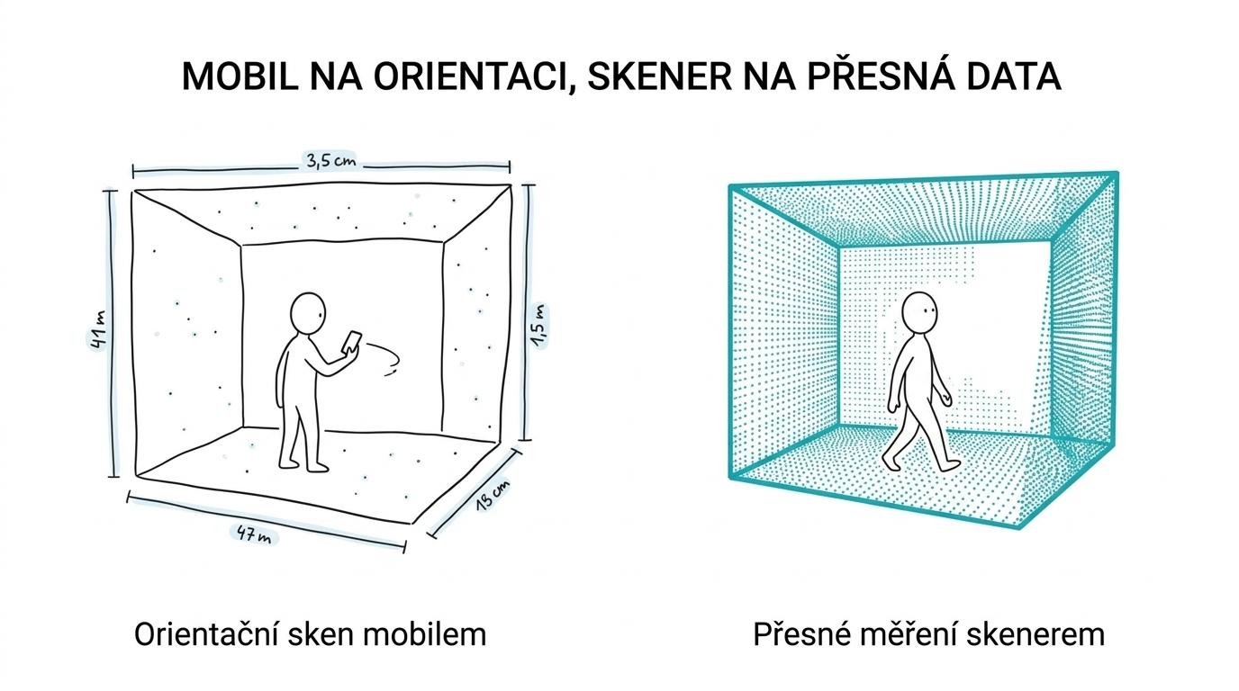
With mobile SLAM LiDAR scanners now used on construction sites and industrial sites, the workflow is much faster than with traditional manual measuring. The operator walks through the building, the scanner continuously captures data, and the result is a point cloud ready for CAD, BIM or GIS. 4CAD’s materials on the scan-to-BIM workflow show how important a single efficient site visit is.
The published specifications of common SLAM devices for construction illustrate this well. FJD Trion P2 is listed with an accuracy of 1 cm, a range of up to 70 m (40 m on surfaces with low reflectivity) and a capture rate of 200,000 points per second. FJD Trion S2 targets longer ranges and larger operations, working with a much denser data stream and a range of up to hundreds of metres. Hybrid models such as FJD Trion T1 combine a mobile mode for a quick walkthrough with a tripod mode for more detailed areas.
That is exactly the point where a phone is no longer enough and a SLAM or hybrid scanner makes sense. Not because of “better technology” as a marketing label, but because of the practical result in the project.
Hybrid workflow: the phone as a quick helper, the scanner as the main data source
The best results often come not from choosing a single tool, but from the right combination. A phone is quick, always at hand and excellent for initial orientation. A dedicated scanner then takes over wherever precise geometry is required.
Such a hybrid workflow makes a lot of sense for refurbishments, building documentation and BIM model preparation. The phone can be used for a preliminary walkthrough, marking priorities, photo documentation and checking access. A follow-up scan with professional equipment then provides the data for modelling, measurement and inspection.
When working with CAD and BIM, it also pays to think about data processing. A point cloud on its own is not yet a finished output. You need to get it into Revit, AutoCAD, Archicad or other tools. The practical side of the scan-to-BIM workflow is also covered in expert articles on 4-cad.cz and in topic materials on Techcad.cz, which clearly show that the quality of the input data directly affects the speed of all subsequent work.
How to choose the right approach for a specific project
The decision is not difficult if you define the goal right at the start. It is not just about what you can use to scan the space, but what should come out of it in a week or a month.
If the output is only for internal communication, an estimate or an initial design, a phone is often good enough. But if you are planning design documentation, coordination of disciplines, building documentation or management of building equipment, it pays to go straight for more accurate measurement.
This short filter helps when choosing the approach:
- Project goal: orientation and a quick overview, or an accurate basis for decisions
- Scene size: a single detail, a room, a whole floor, a hall, a site
- Required accuracy: centimetres, or millimetres at critical points
- Further use of the data: visualisation, BIM, manufacturing, clash detection, building records
- Operational risk: an ordinary room, or a space with building services and VTZ
- Software integration: is an image enough, or do you need a point cloud and a model?
For buildings with technical systems, keep in mind that the data often does not end with one project. It is used for inspections, maintenance, repair planning, refurbishments or handover between owner and tenant. At that point, an indicative phone model is more of a supplement than the main source of information.
Mobile scanning has its firm place. It is fast, accessible and genuinely useful in many situations. But once you need accuracy, longer range and a reliable basis for CAD, BIM or building management, SLAM LiDAR scanners and hybrid workflows take over. And that is the strength of modern construction digitalisation: using the right tool at the right time.


