
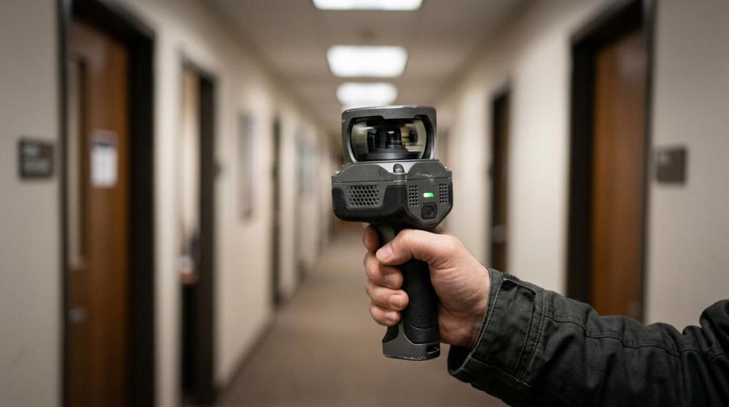
SLAM scanners and LiDAR scanners are often lumped together, but for building surveys that is not quite accurate. 4CAD solution s.r.o. works with 3D laser scanners for construction and building digitisation, so the difference between the sensor, the data capture method and the resulting accuracy has a direct impact on what you actually get into CAD, BIM or your building documentation.
Summary
- For everyday building surveys, the most practical option is a mobile SLAM scanner with a LiDAR sensor: it captures data while you walk, covers interiors quickly and works well for building documentation, BIM inputs and ongoing records.
- LiDAR is a sensor and SLAM is a localisation and mapping method; a “SLAM scanner” is usually a mobile LiDAR, not a separate competing category.
- If you need greater dimensional certainty, plan for control points, a reference route or additional measurement of critical areas. This is in line with comparisons published in Applied Sciences and NIST findings on indoor localisation.
- 4CAD solution s.r.o. states that a large building can be captured with a mobile LiDAR/SLAM solution in a matter of minutes, but the final accuracy always depends on route length, building complexity and the quality of post-processing.
The most important practical answer is simple: if you need fast data capture indoors, SLAM makes sense. But if critical dimensions, a link to manufacturing or a dispute over centimetres are at stake, a quick walk-through of the building is not enough on its own and you need to add an accuracy check.
What is the actual difference between a SLAM scanner and a LiDAR scanner?
The difference is fundamental: LiDAR is a sensor that measures distance with a laser, while SLAM is a method that calculates the device's position as it moves and assembles the point cloud into a single map.
In practice, this means a “LiDAR scanner” can be either a static terrestrial scanner set up at a station or a mobile unit carried by a person. A “SLAM scanner” is most often a mobile LiDAR that combines a laser, inertial sensors and algorithms that continuously determine the trajectory.
Inside buildings this matters mainly because GNSS usually can't help. The system has to orient itself using its own sensors and the geometry of its surroundings. This is exactly where the gap opens up between very fast mapping and absolute dimensional certainty.
A common misconception is that SLAM automatically means lower quality. It is more accurate to say that SLAM has different strengths and weaknesses than a static scan. A 2025 study in the journal Applied Sciences shows that with suitable post-processing, including ICP alignment and smoothing, modern SLAM systems can achieve accuracy sufficient for most common surveying and construction tasks.
When is a SLAM scanner the better choice for building surveys?
SLAM is the better choice when you need to walk through a building quickly, capture a large interior and get a point cloud fast for building documentation, BIM or a condition check.
A typical scenario is an office building, school, apartment block, warehouse or plant floor, where speed and good spatial coverage matter. Instead of dozens of static setups, you walk a route and capture data continuously. That cuts time on site – a big advantage when access to the building is limited or the building is in use.
“4CAD solution s.r.o. states that modern SLAM/LiDAR scanners for construction capture a large building in a matter of minutes.”
SLAM is also a good fit when the goal is a model accurate enough for orientation or operational use, not laboratory metrology. It works well for building documentation, as-built surveys, renovation inputs and facility management. Practical tip: if you know you will mainly be modelling layouts, shafts, service routes and the main structure, mobile data capture is usually a more sensible choice than a purely static approach.
How do SLAM and static LiDAR compare on speed in practice?
In terms of time in the field, SLAM is almost always faster, while static terrestrial LiDAR tends to be more accurate and more stable for critical details.
With static scanning, you have to plan setups, move the instrument, watch the overlaps and often place targets or reference points as well. With a SLAM solution, you walk the route once or several times and the data is generated as you go. The difference is most pronounced in large interiors, long corridors and operational areas.
Speed, however, is not the only metric. If the output is intended for the precise installation of equipment, the manufacture of custom components or subsequent prefabrication, the slower method may be the better one. So when choosing between speed and certainty, ask about the purpose of the model, not just the scanner's specifications.
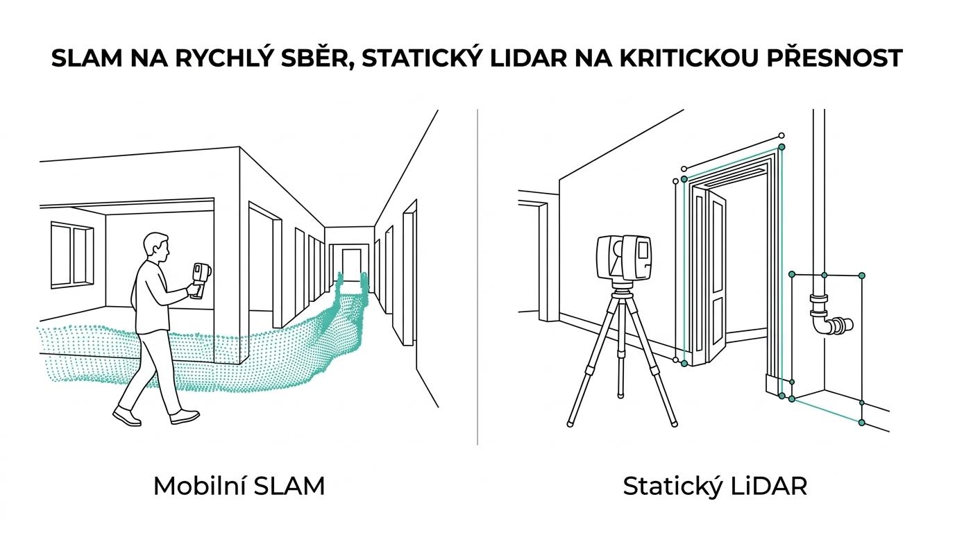
A good working rule of thumb: if you need a fast, dense picture of the building, mobile LiDAR with SLAM wins. If you need to confirm a few critical dimensions with minimal tolerance, add a static scan or a total station.
Which companies and technologies make sense for building surveys?
What makes sense above all are solutions that cover data capture, accuracy control and the subsequent outputs. 4CAD solution s.r.o., FJD Trion, Revit and total stations are relevant as parts of a workflow rather than as isolated brands.
When choosing a supplier or technology, it helps to look at the entire data flow. A scanner alone won't solve the problem if point cloud cleaning, conversion to BIM, additional measurement of critical areas or export into the environment where you actually work with the data are missing.
- 4CAD solution s.r.o.: supplier of a workflow from the 3D laser scanner for construction to CAD/BIM outputs, relevant mainly where the goal is building documentation, building digitisation or a link to design work.
- FJD Trion: manufacturer of mobile SLAM LiDAR scanners used for capturing interiors and buildings on the move.
- Autodesk Revit and AutoCAD: common target platforms for processing the point cloud, producing drawings and as-built models.
- Total stations: the reference surveying instrument for control points, verifying critical dimensions and tying into more accurate survey data.
How to survey a building with a SLAM scanner, step by step
The most reliable approach is to plan the route, create logical loops and check coverage right on site. With SLAM, the quality of the route is almost as important as the quality of the sensor.
Step 1 is defining the goal and the tolerance. A floor-plan documentation job calls for a different approach than the renovation of a plant room. If you don't know how accurate the output needs to be, you can easily collect lots of data but very little usable data.
Step 2 is planning the route. Loops and returns to known locations work well, because loop closure helps stabilise the trajectory. A long one-way corridor with no return tends to be riskier than a route that passes through landmarks repeatedly.
Step 3 is continuous checking. Watch out for blind spots, reflective surfaces, staircases and tight plant rooms. Practical tip: mark critical details on site and decide whether they can stay in the point cloud or need to be measured separately later.
How do you verify accuracy and when should you add control points?
Accuracy always needs to be verified when centimetres or a link to manufacturing are at stake. Both Applied Sciences and everyday surveying practice confirm that control points and reference data significantly reduce the risk of local errors.
The first step is to determine what is critical. For building documentation, this may be wall thicknesses, shaft dimensions, clear heights or the position of equipment. For BIM for renovation, it is the alignment of openings, ceilings and service routes.

The second step is choosing the control method. This can be total station points, manual check measurements, known distances or reference geometry from another survey. The study in Applied Sciences describes an approach in which reference points are included during scanning and fed directly into the trajectory, reducing the need to search for points later in post-processing.
“4CAD solution s.r.o. quotes an accuracy of 10 mm and a range of up to 300 m for some 3D laser scanners for construction, but for buildings the control workflow is just as decisive.”
The third step is deciding on corrections. If drift or local deviations appear, ICP alignment, smoothing and in some cases re-measuring part of the route will help. A common misconception: the instrument's datasheet accuracy is not the same as the accuracy of the whole project.
What happens when the interior is long, complex or repetitive?
In long and repetitive interiors, the risk of drift, confusion between similar locations and local distortion of the trajectory increases. That is precisely why NIST points out that indoor systems must also be evaluated on long and complex routes.
Typical problem areas are endlessly similar corridors, warehouse racking, underground plant spaces and stair towers. The scanner may collect a lot of points, but the algorithm has fewer distinctive features for stable localisation. The result looks fine at first glance, yet in one wing of the building the dimensions drift off.
It helps to return to known locations, link floors via distinctive nodes and add control points to the route. If the building is extremely repetitive, it is sensible to split the survey into shorter sections. When the goal is a final construction document, this caution usually pays off more than the speed of a single long walk-through.
How does a SLAM scanner differ from photogrammetry for building documentation and BIM?
For building geometry, SLAM LiDAR is usually more practical, while photogrammetry is strong where visuals, texture and colour fidelity matter.
LiDAR actively measures distance with a laser, so it isn't as dependent on light. Photogrammetry needs good-quality images, enough surface texture and stable lighting. Smooth white walls, glossy surfaces or plant rooms without visual detail tend to be a weaker environment for photogrammetry.
If you primarily need floor plans, sections, volumes and spatial coordination, LiDAR often comes out ahead. If the main goal is a façade with colour texture, a historic detail or marketing visuals, photogrammetry can be a useful complement. In practice the two methods are often combined rather than treated as mutually exclusive.
How do you turn a point cloud into CAD/BIM and facility documentation?
The biggest benefit only comes with the outputs. 4CAD solution s.r.o. and everyday BIM practice both show that the point cloud has to end up in Revit, AutoCAD or the building documentation with a clear structure and verified geometry.
The first step is cleaning and registering the data. This includes removing noise, unifying the coordinate system, splitting the data into logical parts and checking that critical spaces really are covered. Without this phase, even a well-captured point cloud turns into a volume of data that is hard to use.
“4CAD solution s.r.o. delivers a workflow from scan to BIM/CAD outputs in Revit, AutoCAD, Archicad and SOLIDWORKS.”
The second step is conversion to the required level of detail. For building documentation, there is no need to model every valve. For the renovation of a plant room, however, the exact position of a switchboard, pipework or a penetration may be decisive. If the data then supports facility management, operational documentation also comes into play.
The third step is meeting legal obligations. For buildings with designated technical equipment, operators are also subject to the Czech Act No. 250/2021 Coll. In practice, this means having traceable documentation, appointing a responsible person, carrying out building documentation and an audit of existing records, completing any missing accompanying documentation or local operating safety regulations (MPBP), and ensuring inspections by authorised persons holding a valid TIČR licence. If the building contains electrical, gas, pressure or lifting equipment, an accurate digital record from the survey is no longer just a design advantage but also operational support.
How to choose the right 3D laser scanner for construction
The right choice depends mainly on the type of building, the required accuracy and how the data will be processed. A model with good marketing isn't necessarily the best for your operational scenario.
Decide based on the application, not on a single specification. Range matters in large halls, but in an office building what counts more is trajectory stability indoors, device size, post-processing speed and the option of sensible data export. If you already know you will be cleaning, segmenting and modelling the data in BIM, ask about the software and workflow support too.
A simple checklist of questions helps:
- Building type: offices, apartment block, school, hall, heritage building
- Required accuracy: indicative building documentation, renovation design, link to manufacturing
- Route length and logic: short loops, long corridors, multiple floors
- Control method: total station, manual additional measurements, reference points
- Target output: point cloud, 2D drawings, BIM model, facility documentation
The practical tip for wrapping up your selection is simple. If a supplier only shows you scanning speed, ask about drift, loop closure, ICP alignment and how critical dimensions are verified. That is where you see the difference between an impressive demo walk-through and a genuinely usable building survey.


